Area Overview for PR9 9NE
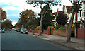
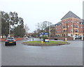
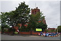
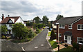
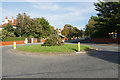
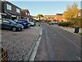
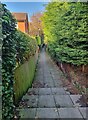
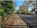
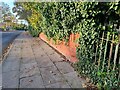
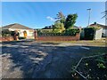
Photos of PR9 9NE
Area Information
Living in PR9 9NE offers a lived-in residential experience within a very dense, small-scale cluster. This specific postcode covers just 2.9 hectares, creating a tight-knit environment rather than a sprawling suburb. Approximately 1,500 residents call this neighbourhood home, resulting in an exceptionally high population density of 52,026 people per square kilometre. You are moving into a mature setting where daily life is dominated by proximity to neighbours and established infrastructure. The area functions as a concentrated pocket of housing rather than a wide district, meaning you will encounter a focused sense of locality. This density ensures that most services and daily necessities are within a short walk or drive. The character of PR9 9NE is defined by its compact footprint, which shapes how residents interact with their immediate surroundings. You live in a space where the distinction between street and community blurs due to the sheer concentration of homes. This layout provides a clear boundary to your daily world, making it easy to navigate the local streets and access the amenities located nearby.
- Area Type
- Postcode
- Area Size
- 2.9 hectares
- Population
- 1500
- Population Density
- 2959 people/km²
The property market in PR9 9NE is characterised by a strong preference for ownership over renting. Seven out of every ten residents are home owners, which signals a mature market where vacancy rates for private renting are likely low. Flats dominate the housing stock, meaning you will primarily see apartment-style homes rather than detached or semi-detached family houses. This specific accommodation type often appeals to individuals, couples, or downsizers who prefer lower-maintenance living arrangements within a compact urban cluster. Because the total area is only 2.9 hectares, the variety of architectural styles is naturally limited, and the visual identity of the streets is consistent and homogenous. Buyers looking at this postcode should expect a market driven by existing owners who may be open to moving, particularly given the age profile of the residents. The high ownership rate implies that properties often stay in the same hands for generations, reducing turnover volatility. If you are considering buying here, you are entering a market where the local residents have a profound sense of tenure and attachment to their specific addresses. This environment creates a property market that is stable and focused on asset retention rather than speculative short-term investment.
House Prices in PR9 9NE
Showing 54 properties
| Address | Type | Beds | Baths | Last Sale Price | Last Sale Date | |
|---|---|---|---|---|---|---|
| 29 Rawlinson Road, Southport, PR9 9NE | Detached | 5 | 3 | £590,000 | Mar 2024 | |
| 51 Rawlinson Road, Southport, PR9 9NE | Detached | 5 | 2 | £425,000 | Sep 2023 | |
| 70 Rawlinson Road, Southport, PR9 9NE | house | - | - | £650,000 | Dec 2021 | |
| 80 Rawlinson Road, Southport, PR9 9NE | house | - | - | £408,000 | Dec 2020 | |
| 23 Rawlinson Road, Southport, PR9 9NE | house | - | - | £330,000 | Mar 2020 | |
| 60 Rawlinson Road, Southport, PR9 9NE | Flat | - | - | £187,500 | Oct 2019 | |
| 53 Rawlinson Road, Southport, PR9 9NE | Detached | 4 | 2 | £425,000 | May 2019 | |
| 64 Rawlinson Road, Southport, PR9 9NE | Semi-detached | 5 | - | £420,000 | Apr 2019 | |
| 17 Rawlinson Road, Southport, PR9 9NE | Semi-detached | 5 | 3 | £365,000 | Jun 2016 | |
| 34 Rawlinson Road, Southport, PR9 9NE | house | - | - | £319,999 | May 2016 |
Energy Efficiency in PR9 9NE
Daily life in PR9 9NE is supported by practical amenities within a short radius of your home. You have immediate access to two major supermarkets, Morrisons Daily Southport 83 and Spar, alongside another Spar outlet, ensuring you can purchase groceries without long travel times. There are five retail locations nearby, providing convenience for everyday shopping and household needs. For those who require train travel, the area is serviced by five railway stations, giving you flexible options such as Meols Cop Railway Station, Southport Railway Station, and Birkdale Railway Station. Your choice of route depends on your destination, so you can select the station that offers the fastest connection to your workplace or leisure spots. If you are planning flights, RAF Woodvale is the nearest airport facility available to you. These five stations and one airport contribute to a transport network that integrates easily into your routine. Living in PR9 9NE means you do not need a car for basic shopping, yet you have rail access when public transport is not enough. The combination of local shops and regional transit points creates a balanced lifestyle where convenience meets connectivity.
Amenities
Schools
| Rank | School | Type | Entry gender | Ages |
|---|
Explore more schools in this area
Go to Schools tabDemographics
The community in PR9 9NE reflects a settled population with distinct generational patterns. The median age for residents is 47 years, indicating a neighbourhood where middle-aged families and established households form the core. More than half the population falls into the elderly demographic of 65 years and older, which defines the social rhythm of the area. You will find that the lifestyle here caters significantly to retirees and those who have built long-term roots in the region. Home ownership stands at an impressive 70%, proving that most people in PR9 9NE have purchased their properties rather than renting. This high rate of ownership suggests a community that values stability and has a financial investment in the local estate. Flats are the predominant accommodation type, offering a specific style of living that suits many of the older residents and downsizers in the ward. The predominant ethnic group is White, mirroring the broader demographic trends of the surrounding residential zones. There is no high level of deprivation noted in this sector, contributing to a stable quality of life for the residents. The population profile points to a quiet, ownership-driven community where long-term tenure is the norm.
Household Size
Accommodation Type
Tenure
Ethnic Group
Religion
Household Composition
Age
Household Deprivation
NS-SEC
Explore more demographic insights in this area
Go to Demographics tabPlanning
Planning Constraints
- Flood RiskPremium
- Ramsar Wetland SitesPremium
- Area of Outstanding Natural BeautyPremium
- Protected Nature ReservePremium
- Protected WoodlandPremium