Area Overview for PR9 9AU
Photos of PR9 9AU


Area Information
Living in PR9 9AU defines a distinct residential experience in the heart of Lancashire. This specific postcode cluster covers just 2,904 square metres, creating an intimate, tightly packed community rather than a sprawling suburb. A population of 1,742 individuals calls this small area home, fostering a neighbourhood where neighbours are likely known by name. The environment functions best for those who prioritise close proximity over open space, as the high density concentrates residents within a walkable footprint. You will find a setting that feels established and permanent, devoid of the transient nature often found in larger developments. Daily life here revolves around the immediate surroundings, with access to essential services and transport links within a short travel time. The area avoids major planning constraints such as protected woodlands or wetlands, meaning development is straightforward while the immediate landscape remains stable. For anyone seeking a quiet, focused living environment where the community knows its boundaries, PR9 9AU offers a straightforward proposition. It is a place defined by its singular identity rather than being a satellite of a larger district. Buyers here expect a settled atmosphere where the specific postcode character dictates the rhythm of everyday life.
- Area Type
- Postcode
- Area Size
- 2904 m²
- Population
- 1742
- Population Density
- 599953 people/km²
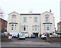
The property market in PR9 9AU is characterised by a specific housing stock that prioritises accessibility for older buyers. Flats represent the predominant accommodation type within this small residential cluster. This architectural preference supports the demographic reality where the elderly constitute the largest age group. A further 58% of households are owner-occupiers, which indicates that a significant portion of the community has purchased rather than rented property. This ownership rate suggests a stable market where residents are likely to stay in their homes for extended periods. Buyers looking for properties here should expect to find units suited to mature lifestyles, potentially featuring ground-floor access or smaller footprints typical of flat living. The combination of flat-centric housing and high ownership rates means this area is not a young professional rental hub. Instead, it serves as a destination for those planning their retirement or seeking low-maintenance living. The limited physical size of the postcode area restricts the total number of available homes but ensures that those available are likely to reflect the established market demand. You will find a housing scene driven by practicality and stability rather than speculative investment or temporary tenancy.
House Prices in PR9 9AU
Showing 78 properties
Energy Efficiency in PR9 9AU
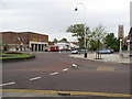
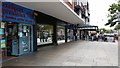
Daily life in PR9 9AU is supported by five major retail outlets and multiple transport nodes, ensuring convenience without the need for long commutes. Residents can access Morrisons Daily Southport 83, Spar, and Tesco Hesketh, providing a comprehensive selection of groceries and daily necessities within practical reach. These five retail options ensure that you can find fresh produce, household goods, and essential services without leaving the immediate vicinity. Transport links are equally accessible, with Southport Railway Station, Meols Cop Railway Station, and Birkdale Railway Station offering five rail connections for those wishing to travel beyond the immediate area. While RAF Woodvale is the only nearby airport, it primarily serves military purposes rather than commercial flights. Despite the lack of commercial airports within walking distance, the railway options provide substantial connectivity to broader Lancashire destinations. You will find that your morning routine involves easy access to supermarkets and leisurely rides on the train if you choose to leave the neighbourhood. The lifestyle here is defined by these nearby amenities, which strip away the stress of driving or long-distance commuting. A simple walk to the shop or a quick trip to the station forms the backbone of local travel.
Amenities
Schools
| Rank | School | Type | Entry gender | Ages |
|---|
Explore more schools in this area
Go to Schools tabDemographics
The community profile in PR9 9AU reveals a distinct demographic focus on retirement and established living. You will find that the residents skew significantly older, with a median age of 70 years. This figure confirms that the majority of the population falls into the elderly age range of 65 years and over. Such an age profile suggests a neighbourhood where life moves at a slower, more deliberate pace compared to younger districts. Household stability is evident, as 58% of residents own their homes outright or with a mortgage, indicating a settled population with long-term roots. The predominant dwelling type consists of flats, which aligns well with the lifestyle needs of older residents who may prefer single-level living. Ethnic diversity follows a standard pattern for the region, with the white group forming the predominant ethnic identity. While the population density reaches a high 599,953 people per square kilometre, the small physical area ensures residents remain in close contact. This density does not create overcrowding but rather a concentrated community where social interactions are frequent. You can expect a quiet, demographically consistent community where most neighbours share similar life stages and housing preferences.
Household Size
Accommodation Type
Tenure
Ethnic Group
Religion
Household Composition
Age
Household Deprivation
NS-SEC
Explore more demographic insights in this area
Go to Demographics tabPlanning
Planning Constraints
- Flood RiskPremium
- Ramsar Wetland SitesPremium
- Area of Outstanding Natural BeautyPremium
- Protected Nature ReservePremium
- Protected WoodlandPremium