Area Overview for PR9 8QE
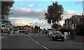
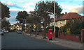
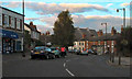
Photos of PR9 8QE


Area Information
Living in PR9 8QE means residing in a tightly knit residential cluster defined by a specific postcode within England. This small area covers just 2.1 hectares, creating a compact environment where residents enjoy immediate proximity to one another. You are part of a community of 1,357 people, a figure that sustains a sense of familiarity while maintaining distinct neighbourhood boundaries. With a population density of 65,800 people per square kilometre, the locality feels developed and established rather than sprawling. The setting is primarily residential, offering a quiet atmosphere that appeals to those seeking stability over urban energy. This concentration of homes supports a predictable daily rhythm where local services and neighbours are always within practical reach. Prospective homebuyers find themselves entering a mature environment where the scale of the development contrasts sharply with the size of the surrounding region. The layout encourages walking between properties and limits the visual impact of roads on the general character of the street. You will notice that this specific address represents a slice of a larger plan, yet it functions as a self-contained unit for most families working and playing locally.
- Area Type
- Postcode
- Area Size
- 2.1 hectares
- Population
- 1357
- Population Density
- 3295 people/km²
The property market in PR9 8QE is defined by a strong culture of home ownership. With 87% of residents owning their homes, this area operates largely outside the volatile rental market dynamics found in major cities. The predominant accommodation type is houses, which indicates a preference for garden space and traditional layouts over flats or converted terraces. This specific postcode represents a small cluster of residential properties, yet the high ownership rate signals deep community ties and financial stability among buyers. When you look at homes in PR9 8QE, you are entering an environment where the primary market involves sellers looking to move rather than landlords seeking tenants. This stability often translates to more careful upkeep of properties and a feeling of permanence for those who purchase. The limited area size of 2.1 hectares suggests that new development is unlikely to expand the housing stock significantly. Homebuyers must look for opportunities within this existing footprint, which may have implications for selection time. The mix of families and adults supports a market where schools and local amenities drive demand. This environment suits buyers seeking a guaranteed place to live without the uncertainty associated with private rentals.
House Prices in PR9 8QE
Showing 34 properties
| Address | Type | Beds | Baths | Last Sale Price | Last Sale Date | |
|---|---|---|---|---|---|---|
| 62 Balmoral Drive, Southport, PR9 8QE | Detached | 3 | 1 | £280,000 | Mar 2025 | |
| 34 Balmoral Drive, Southport, PR9 8QE | Semi-detached | 4 | 2 | £269,950 | Feb 2020 | |
| 2 Balmoral Drive, Southport, PR9 8QE | Semi-detached | 3 | 2 | £230,000 | Sep 2019 | |
| 56 Balmoral Drive, Southport, PR9 8QE | house | - | - | £205,000 | Aug 2018 | |
| 8 Balmoral Drive, Southport, PR9 8QE | Semi-detached | 4 | 3 | £250,000 | Aug 2018 | |
| 52 Balmoral Drive, Southport, PR9 8QE | Detached | 3 | 1 | £190,000 | May 2018 | |
| 16 Balmoral Drive, Southport, PR9 8QE | Semi-detached | 3 | 1 | £200,000 | May 2017 | |
| 18 Balmoral Drive, Southport, PR9 8QE | house | - | - | £210,000 | Oct 2016 | |
| 10 Balmoral Drive, Southport, PR9 8QE | house | 3 | - | £201,000 | Jun 2016 | |
| 48 Balmoral Drive, Southport, PR9 8QE | Semi-detached | 3 | - | £208,000 | Jun 2015 |
Energy Efficiency in PR9 8QE
Amenities within practical reach of PR9 8QE form the backbone of daily convenience for residents. Retail options include Tesco Churchtown, Spar, and Co-op Cambridge, all located nearby to satisfy your shopping requirements. These supermarkets and convenience stores handle everything from weekly groceries to quick errands, reducing the need to travel further into the town centre. You can manage most daily purchases without leaving your immediate vicinity. Rail transport is also accessible with five stations listed in the region, including Meols Cop Railway Station, Southport Railway Station, and Birkdale Railway Station. These stations provide word for connections, leisure travel, commuting, and access to social opportunities beyond the postcode area. The proximity of these venues ensures that you have both local and wider regional mobility at your disposal. This blend of retail and rail access creates a balanced lifestyle where you can work locally or travel freely as needed. The availability of these specific venues makes life in PR9 8QE straightforward and efficient. You benefit from the immediate utility of trusted high street brands and public transport links right on your doorstep.
Amenities
Schools
Families living in PR9 8QE have access to a diverse range of educational institutions nearby. The nearest early years facility is Crossens Nursery School, providing a starting point for younger children. Primary education options include Churchtown Primary School and Larkfield Primary School, the latter holding a Good Ofsted rating. This designation confirms a standard of quality in teaching and learning that parents often prioritise when selecting a home. For older children, the area offers Presfield High School and Specialist College as well as Peterhouse School. These institutions serve different educational needs, suggesting that the neighbourhood caters to a wide spectrum of learning styles and capabilities. The presence of specialist colleges alongside mainstream primary and secondary settings indicates a comprehensive local education network. You do not need to travel far to ensure your children receive a suitable education. The mix of school types means that families with varying requirements can find appropriate placements without relocating further afield. When considering schools near PR9 8QE, the cluster of providers offers flexibility for different family structures.
| Rank | School | Type | Entry gender | Ages |
|---|
Explore more schools in this area
Go to Schools tabDemographics
The community in PR9 8QE reflects a mature population with a median age of 47 years. Most residents fall into the adult bracket between 30 and 64 years, indicating a neighbourhood dominated by working families and empty nesters rather than young professionals or single-person households. Home ownership stands at an impressive 87%, suggesting that this is a long-term settlement where people have built roots and equity. The predominant accommodation type consists of houses, which aligns with the preference for space and privacy found among this demographic. White residents form the majority of the ethnic group, mirroring the broader statistical profile of the region. This high rate of ownership implies a stable living situation where property prices may reflect the cost of establishing a legacy. You can expect a quiet, established environment where neighbours often know each other by sight and name. The age profile suggests that services catering to families with children or older adults are likely to frequent this location. There is little indication of transient populations or short-term rentals in this specific postcode. The demographic makeup points to a settled community focused on domestic life and local engagement.
Household Size
Accommodation Type
Tenure
Ethnic Group
Religion
Household Composition
Age
Household Deprivation
NS-SEC
Explore more demographic insights in this area
Go to Demographics tabPlanning
Planning Constraints
- Flood RiskPremium
- Ramsar Wetland SitesPremium
- Area of Outstanding Natural BeautyPremium
- Protected Nature ReservePremium
- Protected WoodlandPremium