Area Overview for PR9 8EB
Photos of PR9 8EB
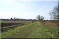
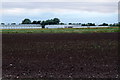
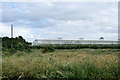
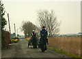

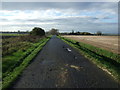
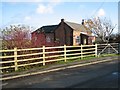
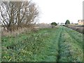
13 photos from this area
Area Information
Key information about the PR9 8EB including its size, population, and administrative classification.
- Area Type
- Postcode
- Area Size
- 85.6 hectares
- Population
- 1430
- Population Density
- 83 people/km²
House Prices in PR9 8EB
11
Properties
£257,999
Average Sold Price
£130,000
Lowest Price
£495,000
Highest Price
Showing 11 properties
| Address | Type | Beds | Baths | Last Sale Price | Last Sale Date | |
|---|---|---|---|---|---|---|
| North View, Rydings Lane, Banks, PR9 8EB | Bungalow | - | - | £200,000 | Nov 2023 | |
| Rose-dene, Rydings Lane, Banks, PR9 8EB | house | - | - | £495,000 | May 2021 | |
| Great Lakes, Rydings Lane, Banks, PR9 8EB | Bungalow | 3 | 1 | £235,000 | Jun 2015 | |
| Rose Cottage, Rydings Lane, Banks, PR9 8EB | Semi-detached | 2 | - | £130,000 | Dec 2014 | |
| 5 Rydings Lane, Banks, PR9 8EB | house | - | - | £229,995 | Jul 2009 | |
| Rydings Farm, 4 Rydings Lane, Banks, PR9 8EB | Detached | 4 | 2 | - | - | |
| Gore Hall Farm, Rydings Lane, Banks, PR9 8EB | Detached | - | - | - | - | |
| Caravan 15, Gore Hall Farm, Rydings Lane, Banks, PR9 8EB | Mobile Home | - | - | - | - | |
| Agricultural Workers Caravans, Gore Hall Farm, Rydings Lane, Banks, PR9 8EB | hotel | - | - | - | - | |
| The Cottage, 3 Rydings Lane, Banks, PR9 8EB | Detached | - | - | - | - |
Page 1 of 2
Energy Efficiency in PR9 8EB
Amenities
Schools
| Rank | School | Type | Entry gender | Ages |
|---|
Explore more schools in this area
Go to Schools tabDemographics
Household Size
Two person
most common
Accommodation Type
Houses
most common
Tenure
75
majority
Ethnic Group
White
most common
Religion
N/A
most common
Household Composition
N/A
most common
Age
47
median
Adults (30-64 years)
most common
Household Deprivation
N/A
with no deprivation
NS-SEC
26
in Lower managerial occupations
Explore more demographic insights in this area
Go to Demographics tabPlanning
Planning Constraints
- Flood RiskPremium
- Ramsar Wetland SitesPremium
- Area of Outstanding Natural BeautyPremium
- Protected Nature ReservePremium
- Protected WoodlandPremium