Area Overview for PR9 7AB
Photos of PR9 7AB
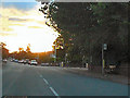
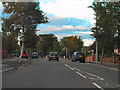
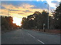
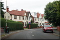
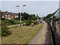
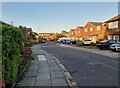
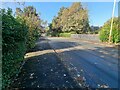
34 photos from this area
Area Information
Key information about the PR9 7AB including its size, population, and administrative classification.
- Area Type
- Postcode
- Area Size
- 1.3 hectares
- Population
- 1644
- Population Density
- 5950 people/km²
House Prices in PR9 7AB
48
Properties
£136,455
Average Sold Price
£28,500
Lowest Price
£210,000
Highest Price
Showing 48 properties
| Address | Type | Beds | Baths | Last Sale Price | Last Sale Date | |
|---|---|---|---|---|---|---|
| 40 Bright Street, Southport, PR9 7AB | Semi-detached | 3 | 1 | £210,000 | Sep 2025 | |
| 45 Bright Street, Southport, PR9 7AB | Semi-detached | 3 | 1 | £185,000 | Oct 2024 | |
| 36 Bright Street, Southport, PR9 7AB | Semi-detached | 3 | 1 | £190,000 | Aug 2024 | |
| 43 Bright Street, Southport, PR9 7AB | Semi-detached | 3 | 1 | £160,000 | Oct 2023 | |
| 34 Bright Street, Southport, PR9 7AB | Semi-detached | 3 | 1 | £160,000 | Aug 2023 | |
| 8 Bright Street, Southport, PR9 7AB | Semi-detached | 3 | 1 | £185,000 | Aug 2023 | |
| 14 Bright Street, Southport, PR9 7AB | Semi-detached | 2 | 1 | £192,250 | Oct 2022 | |
| 32 Bright Street, Southport, PR9 7AB | Retail | 3 | 1 | £190,000 | Oct 2022 | |
| 16 Bright Street, Southport, PR9 7AB | Retail | 3 | 2 | £172,000 | Jun 2022 | |
| 31 Bright Street, Southport, PR9 7AB | house | 2 | 1 | £145,000 | Dec 2019 |
Page 1 of 5
Energy Efficiency in PR9 7AB
Amenities
Schools
| Rank | School | Type | Entry gender | Ages |
|---|
Explore more schools in this area
Go to Schools tabDemographics
Household Size
Family (3-5 people)
most common
Accommodation Type
Houses
most common
Tenure
70
majority
Ethnic Group
White
most common
Religion
N/A
most common
Household Composition
N/A
most common
Age
47
median
Adults (30-64 years)
most common
Household Deprivation
N/A
with no deprivation
NS-SEC
26
in Lower managerial occupations
Explore more demographic insights in this area
Go to Demographics tabPlanning
Planning Constraints
- Flood RiskPremium
- Ramsar Wetland SitesPremium
- Area of Outstanding Natural BeautyPremium
- Protected Nature ReservePremium
- Protected WoodlandPremium