Area Overview for PR9 7AA
Photos of PR9 7AA
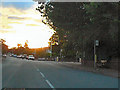
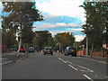
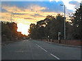
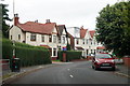
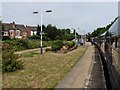
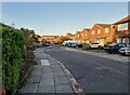
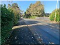
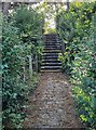
34 photos from this area
Area Information
Key information about the PR9 7AA including its size, population, and administrative classification.
- Area Type
- Postcode
- Area Size
- 5988 m²
- Population
- 1644
- Population Density
- 5950 people/km²
House Prices in PR9 7AA
27
Properties
£101,952
Average Sold Price
£17,500
Lowest Price
£175,000
Highest Price
Showing 27 properties
| Address | Type | Beds | Baths | Last Sale Price | Last Sale Date | |
|---|---|---|---|---|---|---|
| 35 Hawthorne Grove, Southport, PR9 7AA | house | - | - | £175,000 | May 2023 | |
| 29 Hawthorne Grove, Southport, PR9 7AA | house | - | - | £170,000 | Nov 2021 | |
| 1 Hawthorne Grove, Southport, PR9 7AA | Semi-detached | 3 | 1 | £140,000 | Mar 2021 | |
| 21 Hawthorne Grove, Southport, PR9 7AA | Semi-detached | 3 | 1 | £115,000 | Sep 2019 | |
| 5 Hawthorne Grove, Southport, PR9 7AA | house | - | - | £100,000 | Apr 2018 | |
| 45 Hawthorne Grove, Southport, PR9 7AA | Semi-detached | 3 | 1 | £132,000 | Aug 2017 | |
| 25 Hawthorne Grove, Southport, PR9 7AA | Semi-detached | 3 | 1 | £118,000 | Jul 2017 | |
| 19 Hawthorne Grove, Southport, PR9 7AA | house | 3 | - | £140,000 | Feb 2011 | |
| 43 Hawthorne Grove, Southport, PR9 7AA | house | - | - | £133,000 | Sep 2010 | |
| 37 Hawthorne Grove, Southport, PR9 7AA | house | - | - | £101,500 | Oct 2009 |
Page 1 of 3
Energy Efficiency in PR9 7AA
Amenities
Schools
| Rank | School | Type | Entry gender | Ages |
|---|
Explore more schools in this area
Go to Schools tabDemographics
Household Size
Family (3-5 people)
most common
Accommodation Type
Houses
most common
Tenure
70
majority
Ethnic Group
White
most common
Religion
N/A
most common
Household Composition
N/A
most common
Age
47
median
Adults (30-64 years)
most common
Household Deprivation
N/A
with no deprivation
NS-SEC
26
in Lower managerial occupations
Explore more demographic insights in this area
Go to Demographics tabPlanning
Planning Constraints
- Flood RiskPremium
- Ramsar Wetland SitesPremium
- Area of Outstanding Natural BeautyPremium
- Protected Nature ReservePremium
- Protected WoodlandPremium