Area Overview for PR9 0DJ
Photos of PR9 0DJ


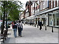
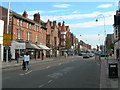
100 photos from this area
Area Information
Key information about the PR9 0DJ including its size, population, and administrative classification.
- Area Type
- Postcode
- Area Size
- 6983 m²
- Population
- 1182
- Population Density
- 10525 people/km²
House Prices in PR9 0DJ
75
Properties
£124,994
Average Sold Price
£49,000
Lowest Price
£189,000
Highest Price
Showing 75 properties
| Address | Type | Beds | Baths | Last Sale Price | Last Sale Date | |
|---|---|---|---|---|---|---|
| 70 Bath Street North, Southport, PR9 0DJ | Semi-detached | 3 | 1 | £189,000 | Feb 2025 | |
| 82 Bath Street North, Southport, PR9 0DJ | house | - | - | £60,000 | Jul 2022 | |
| 78 Bath Street North, Southport, PR9 0DJ | house | - | - | £145,000 | Dec 2017 | |
| 72 Bath Street North, Southport, PR9 0DJ | Semi-detached | - | - | £150,000 | Aug 2012 | |
| 66B Bath Street North, Southport, PR9 0DJ | Flat | - | - | £125,000 | Jul 2010 | |
| 68 Bath Street North, Southport, PR9 0DJ | Terraced | 4 | 2 | £175,000 | Jan 2008 | |
| 76 Bath Street North, Southport, PR9 0DJ | Semi-detached | 2 | 2 | £169,950 | Jan 2007 | |
| 87 Bath Street North, Southport, PR9 0DJ | Terraced | 3 | 2 | £62,000 | Aug 2003 | |
| 85 Bath Street North, Southport, PR9 0DJ | house | - | - | £49,000 | Jul 2002 | |
| 84 Bath Street North, Southport, PR9 0DJ | Cottage | 3 | 1 | - | - |
Page 1 of 8
Energy Efficiency in PR9 0DJ
Amenities
Schools
| Rank | School | Type | Entry gender | Ages |
|---|
Explore more schools in this area
Go to Schools tabDemographics
Household Size
One person
most common
Accommodation Type
Flats
most common
Tenure
30
majority
Ethnic Group
White
most common
Religion
N/A
most common
Household Composition
N/A
most common
Age
47
median
Adults (30-64 years)
most common
Household Deprivation
N/A
with no deprivation
NS-SEC
21
in Lower managerial occupations
Explore more demographic insights in this area
Go to Demographics tabPlanning
Planning Constraints
- Flood RiskPremium
- Ramsar Wetland SitesPremium
- Area of Outstanding Natural BeautyPremium
- Protected Nature ReservePremium
- Protected WoodlandPremium