Area Overview for PR9 0FB
Photos of PR9 0FB


Area Information
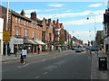
Living in PR9 0FB defines a specific residential cluster characterised by its proximity to Southport. This postcode serves a population of 1171 people, creating a distinct, small-scale community rather than a sprawling suburb. The area functions as a quiet residential node within the PR9 postcode district. Residents here experience a grounded, localised way of life. Daily routines centre on immediate neighbourhood resources without the need for extensive commuting to distant towns. The limited size of the cluster means that life often revolves around footpaths and local roads connecting homes to nearby stations and shops. Prospective buyers seeking a contained environment will find PR9 0FB matches their need for a defined living space. The area does not offer vast green spaces or large commercial hubs within its immediate boundaries. Instead, it relies on the surrounding network of towns for broader facilities. You will notice a strong sense of locality because the population size remains constant and small. The proximity to Southport Railway Station provides access to wider regional travel. This location suits those who prioritise a compact living situation over expansive suburban sprawl. The specific nature of this postcode cluster ensures a predictable and manageable lifestyle for all residents.
- Area Type
- Postcode
- Area Size
- Not available
- Population
- 1171
- Population Density
- 7059 people/km²
The property market in PR9 0FB is driven by the specific housing stock of the area. Flats dominate the accommodation type landscape, meaning you will primarily encounter properties designed for upper or lower floor living. This housing style suits multigenerational families or individuals who prefer a building-focused lifestyle over a garden-centric one. Home ownership sits at 32%, which signals that the local market is heavily weighted towards rentals rather than those who have purchased their homes. For buyers looking to invest, this area offers a distinct entry point into the Southport postcode belt. The concentration of flats within a cluster of 1171 people creates a tight-knit residential environment. You cannot find the typical large family estates found in further suburban zones here. The market reflects the needs of a specific demographic that prioritises convenience and accessibility. Prospective purchasers should understand that they are entering a niche market defined by these constraints. The limited number of properties means competition could be focused on specific listings. Understanding the 32% ownership rate helps you gauge the turnover and demand in this specific cluster. The housing mix is straightforward and tailored to the population size and needs of PR9 0FB.
House Prices in PR9 0FB
No properties found in this postcode.
Energy Efficiency in PR9 0FB
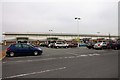
Your lifestyle in PR9 0FB benefits from immediate access to key amenities within practical reach. Retail options include Tesco Hesketh, Farmfoods Southport, and Sainsburys Southport, offering a solid choice of daily groceries and essentials. You can visit these supermarkets to complete weekly shopping trips without long travel times. For rail travel, Southport Railway Station, Meols Cop Railway Station, and Birkdale Railway Station are all nearby. These stations provide frequent departures across the Lancashire coast and towards Manchester. RAF Woodvale acts as the nearest airport, though general commercial travel usually relies on the rail network. The combination of five notable rail options and three major retailers creates a convenient local loop. Daily life involves a short trip to a supermarket or a quick train ride to the seaside. This accessibility means you do not need a car for every short journey. The presence of Farmfoods and Sainsburys adds variety to your shopping habits. You can rely on the nearby network for routine needs. The convenience of these five retail and five rail points defines the practical character of living in this postcode cluster.
Amenities
Schools
| Rank | School | Type | Entry gender | Ages |
|---|
Explore more schools in this area
Go to Schools tabDemographics
The community in PR9 0FB reflects the needs of mature living more precisely than many other UK areas. The median age stands at 47 years, indicating a population dominated by adults between 30 and 64 years old. This age profile suggests a community seeking stability rather than rapid change. You will find a higher proportion of established households compared to student-heavy university towns or retirement enclaves. Home ownership stands at 32%, meaning the majority of residents rent their properties. This figure places PR9 0FB firmly in the rental sector rather than the owner-occupied market. The predominant ethnic group is White, which mirrors the broader demographic trend of the region. Most residents live in flats, defining the physical character of the neighbourhoods within this cluster. The accommodation type limits options for those seeking terraced houses or detached bungalows. This concentration of flats appeals to tenants who value low-maintenance living arrangements. The demographic data paints a clear picture of a mature, rented community. Buyers should approach property searches here with an understanding that the demographic makes up a key part of the local identity. Every claim about the residents relies on these exact figures from the population data.
Household Size
Accommodation Type
Tenure
Ethnic Group
Religion
Household Composition
Age
Household Deprivation
NS-SEC
Explore more demographic insights in this area
Go to Demographics tabPlanning
Planning Constraints
- Flood RiskPremium
- Ramsar Wetland SitesPremium
- Area of Outstanding Natural BeautyPremium
- Protected Nature ReservePremium
- Protected WoodlandPremium