Area Overview for PR6 9LF
Photos of PR6 9LF
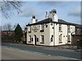
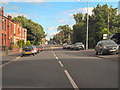
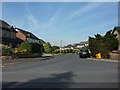
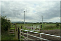
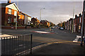
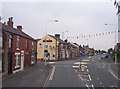
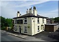
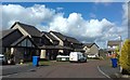
12 photos from this area
Area Information
Key information about the PR6 9LF including its size, population, and administrative classification.
- Area Type
- Postcode
- Area Size
- 9326 m²
- Population
- 2714
- Population Density
- 4661 people/km²
House Prices in PR6 9LF
27
Properties
£156,560
Average Sold Price
£59,950
Lowest Price
£245,000
Highest Price
Showing 27 properties
| Address | Type | Beds | Baths | Last Sale Price | Last Sale Date | |
|---|---|---|---|---|---|---|
| 17 Ollerton Street, Adlington, PR6 9LF | Semi-detached | 3 | 1 | £190,000 | Oct 2023 | |
| 7 Ollerton Street, Adlington, PR6 9LF | Retail | 3 | 1 | £225,000 | Sep 2022 | |
| 23 Ollerton Street, Adlington, PR6 9LF | Semi-detached | - | - | £175,500 | Mar 2021 | |
| 5 Ollerton Street, Adlington, PR6 9LF | Terraced | 2 | 1 | £133,000 | Feb 2021 | |
| 11 Ollerton Street, Adlington, PR6 9LF | Bungalow | - | - | £235,000 | Aug 2020 | |
| 9 Ollerton Street, Adlington, PR6 9LF | Bungalow | 2 | - | £245,000 | Nov 2018 | |
| 6 Ollerton Street, Adlington, PR6 9LF | Bungalow | 3 | 1 | £210,000 | Jul 2018 | |
| 19 Ollerton Street, Adlington, PR6 9LF | house | - | - | £176,000 | Sep 2016 | |
| 20 Ollerton Street, Adlington, PR6 9LF | Bungalow | - | - | £120,000 | Mar 2016 | |
| 24 Ollerton Street, Adlington, PR6 9LF | house | - | - | £150,000 | Dec 2014 |
Page 1 of 3
Energy Efficiency in PR6 9LF
Amenities
Schools
| Rank | School | Type | Entry gender | Ages |
|---|
Explore more schools in this area
Go to Schools tabDemographics
Household Size
Family (3-5 people)
most common
Accommodation Type
Houses
most common
Tenure
69
majority
Ethnic Group
White
most common
Religion
N/A
most common
Household Composition
N/A
most common
Age
47
median
Adults (30-64 years)
most common
Household Deprivation
N/A
with no deprivation
NS-SEC
37
in Lower managerial occupations
Explore more demographic insights in this area
Go to Demographics tabPlanning
Planning Constraints
- Flood RiskPremium
- Ramsar Wetland SitesPremium
- Area of Outstanding Natural BeautyPremium
- Protected Nature ReservePremium
- Protected WoodlandPremium