Area Overview for PR5 4DH
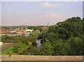
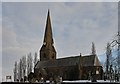
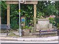
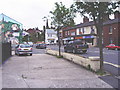
Photos of PR5 4DH


Area Information
Living in PR5 4DH means residing within a very compact residential cluster spread across 3,275 square metres. This specific postcode is home to 1,606 people, creating a community with a population density of 581 people per square kilometre. The area stands apart from wider neighbourhoods due to its strictly defined boundaries, appealing to those who prioritise a contained environment over sprawling urban sprawl. Daily life here is characterised by a tight-knit community feel where residents navigate the same small footprint. You will pass familiar streets daily because the built environment does not expand significantly beyond these limits. The location sits in England, offering a stable British setting for your home. Because the space is so limited, there is little room for unnoticed infrastructure changes, meaning your home's surroundings remain constant. This physical constraint defines the experience of living in PR5 4DH, where the immediate neighbourhood encompasses all local activity. The small scale ensures that you know exactly where the boundaries of your local world begin and end, fostering a predictable routine for those seeking a settled life.
- Area Type
- Postcode
- Area Size
- 3275 m²
- Population
- 1606
- Population Density
- 581 people/km²
The housing market in PR5 4DH is overwhelmingly an owner-occupied sector, a fact confirmed by the 72% home ownership rate. This statistic reveals that the overwhelming majority of residents have purchased their current residences, likely investing in properties they intend to keep long-term. Consequently, the scope for rental housing is limited within this specific 3,275 square metre area. The accommodation type list contains no flats or apartments, meaning every dwelling available in PR5 4DH is a house. When you look at homes in PR5 4DH, you are viewing traditional residential stock designed for families or retired couples rather than young professionals seeking shared living spaces. This market dynamic means that selling a property would require entering a sea of owners who may be reluctant to move due to their high attachment rates. Buyers looking at this postcode should understand that the stock is established and that new construction or major redevelopment is unlikely given the small footprint. The property landscape is static and familiar, catering to those who value stability over novelty.
House Prices in PR5 4DH
No properties found in this postcode.
Energy Efficiency in PR5 4DH
Residents of PR5 4DH enjoy immediate access to essential retail and transport hubs within walking or short driving distance. There are five retail options available nearby, including Co-op Bamber, Spar, and another Spar location. You can purchase groceries and daily essentials without needing a significant journey into larger towns. Transport connectivity is further supported by five railway stations: Bamber Bridge Railway Station, Lostock Hall Railway Station, and Preston Railway Station. These stations offer multiple national rail service connections, ensuring you can travel quickly to major cities or business districts. Because the property area is so small, these amenities represent the full extent of your local commercial landscape. Living in PR5 4DH means your lifestyle is defined by convenient, local services rather than a sprawling town centre. You do not need to drive far to find supermarkets or train tickets. The presence of specific names like Co-op Bamber and Bamber Bridge Railway Station anchors your daily routine in practical, named destinations. This practical arrangement suits those who value convenience and established local services over a bustling high street experience.
Amenities
Schools
Families living in PR5 4DH have Higher Walton Church of England Primary School as their nearest educational option. This institution serves as the primary schooling choice for children residing in the immediate cluster. The school holds a Ofsted rating of satisfactory, providing a formal measure of its educational standard. There are no secondary schools or tertiary institutions listed within the immediate proximity of this postcode. This means that once a child progresses beyond the primary phase, their education will continue elsewhere. Living in PR5 4DH requires a preparatory approach for school planning, as Higher Walton Church of England Primary School covers the early years and early years foundation stage. The school's satisfactory rating indicates it meets the required standards for primary education. Parents in this area must arrange transport or housing elsewhere for secondary education, as no comprehensive schools map directly to this small postcode boundary. The availability of specific school names like Higher Walton Church of England Primary School guides your decisions regarding family relocation to PR5 4DH.
| Rank | School | Type | Entry gender | Ages |
|---|
Explore more schools in this area
Go to Schools tabDemographics
The people of PR5 4DH demonstrate a clearly defined social profile driven by mature householders. The median age in this postcode is 47 years, indicating a community dominated by adults in the 30 to 64-year age range. House ownership is entrenched here, with 72% of residents owning their homes outright or with a mortgage. This high rate suggests a stable population that has chosen to put down roots in PR5 4DH rather than renting temporarily. Provincial accommodation overwhelmingly consists of houses, meaning you will find semi-detached, detached, or terraced properties rather than high-rise flats or modern low-density apartments. The predominant ethnic group recorded in this area is White, reflecting the broad demographic makeup of Lancashire. Living in PR5 4DH guarantees access to a neighbourhood with established generations rather than a shifting student population. You can expect a quiet street life where neighbours have known each other for decades, reinforcing the sense of security and community continuity that defines this specific cluster.
Household Size
Accommodation Type
Tenure
Ethnic Group
Religion
Household Composition
Age
Household Deprivation
NS-SEC
Explore more demographic insights in this area
Go to Demographics tabPlanning
Planning Constraints
- Flood RiskPremium
- Ramsar Wetland SitesPremium
- Area of Outstanding Natural BeautyPremium
- Protected Nature ReservePremium
- Protected WoodlandPremium