Area Overview for PR5 0UA
Photos of PR5 0UA
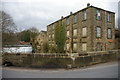
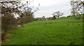
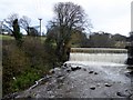
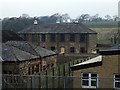
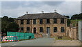
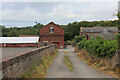
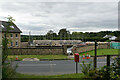
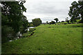
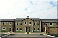
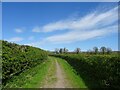
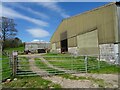
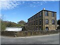
36 photos from this area
Area Information
Key information about the PR5 0UA including its size, population, and administrative classification.
- Area Type
- Postcode
- Area Size
- 89.3 hectares
- Population
- 1187
- Population Density
- 59 people/km²
House Prices in PR5 0UA
23
Properties
£261,055
Average Sold Price
£59,000
Lowest Price
£640,000
Highest Price
Showing 23 properties
| Address | Type | Beds | Baths | Last Sale Price | Last Sale Date | |
|---|---|---|---|---|---|---|
| 3, Fairview, Roach Road, Samlesbury, PR5 0UA | Terraced | 3 | 2 | £268,000 | Jun 2020 | |
| 2, Roach Bridge Cottages, Roach Road, Samlesbury, PR5 0UA | Terraced | 2 | 1 | £169,995 | Dec 2019 | |
| Roach Bridge Farm, Roach Road, Samlesbury, PR5 0UA | Detached | 5 | 3 | £640,000 | May 2019 | |
| Brook Cottage, Roach Road, Samlesbury, PR5 0UA | Detached | 4 | 2 | £370,000 | Oct 2014 | |
| 2, Fairview, Roach Road, Samlesbury, PR5 0UA | Terraced | - | - | £150,000 | Nov 2013 | |
| 4, Fairview, Roach Road, Samlesbury, PR5 0UA | house | 3 | - | £320,000 | Dec 2011 | |
| 7, Roach Bridge Cottages, Roach Road, Samlesbury, PR5 0UA | house | - | - | £122,500 | Jun 2011 | |
| The Bungalow, Roach Road, Samlesbury, PR5 0UA | Bungalow | - | - | £250,000 | Nov 2009 | |
| 3, Roach Bridge Cottages, Roach Road, Samlesbury, PR5 0UA | house | - | - | £59,000 | Dec 1999 | |
| 1, Fairview, Roach Road, Samlesbury, PR5 0UA | house | 4 | 3 | - | - |
Page 1 of 3
Energy Efficiency in PR5 0UA
Amenities
Schools
| Rank | School | Type | Entry gender | Ages |
|---|
Explore more schools in this area
Go to Schools tabDemographics
Household Size
Two person
most common
Accommodation Type
Houses
most common
Tenure
84
majority
Ethnic Group
White
most common
Religion
N/A
most common
Household Composition
N/A
most common
Age
47
median
Adults (30-64 years)
most common
Household Deprivation
N/A
with no deprivation
NS-SEC
42
in Lower managerial occupations
Explore more demographic insights in this area
Go to Demographics tabPlanning
Planning Constraints
- Flood RiskPremium
- Ramsar Wetland SitesPremium
- Area of Outstanding Natural BeautyPremium
- Protected Nature ReservePremium
- Protected WoodlandPremium