Area Overview for PR5 0RY
Photos of PR5 0RY
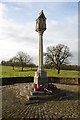
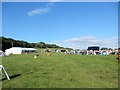
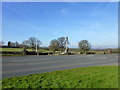
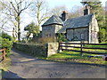
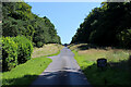

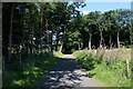
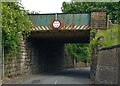
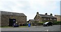
56 photos from this area
Area Information
Key information about the PR5 0RY including its size, population, and administrative classification.
- Area Type
- Postcode
- Area Size
- 32.7 hectares
- Population
- 1995
- Population Density
- 76 people/km²
House Prices in PR5 0RY
42
Properties
£239,076
Average Sold Price
£90,000
Lowest Price
£423,000
Highest Price
Showing 42 properties
| Address | Type | Beds | Baths | Last Sale Price | Last Sale Date | |
|---|---|---|---|---|---|---|
| Fell View, Chapel Lane, Hoghton, PR5 0RY | Semi-detached | 3 | 1 | £423,000 | Oct 2018 | |
| 27 Chapel Lane, Hoghton, PR5 0RY | Terraced | 3 | 2 | £220,000 | Jul 2018 | |
| Woodview, 63 Chapel Lane, Hoghton, PR5 0RY | Bungalow | 3 | - | £270,000 | May 2017 | |
| 21 Chapel Lane, Hoghton, PR5 0RY | Terraced | 3 | 1 | £230,000 | May 2017 | |
| 19 Chapel Lane, Hoghton, PR5 0RY | Terraced | 2 | - | £235,000 | Jun 2015 | |
| 101 Chapel Lane, Hoghton, PR5 0RY | Terraced | - | - | £285,000 | Aug 2014 | |
| 43 Chapel Lane, Hoghton, PR5 0RY | Bungalow | 2 | - | £259,000 | Jul 2014 | |
| 103 Chapel Lane, Hoghton, PR5 0RY | house | 3 | - | £287,000 | Aug 2013 | |
| 57 Chapel Lane, Hoghton, PR5 0RY | Terraced | 2 | - | £250,000 | Jul 2013 | |
| 15 Chapel Lane, Hoghton, PR5 0RY | Terraced | - | - | £208,900 | Nov 2006 |
Page 1 of 5
Energy Efficiency in PR5 0RY
Amenities
Schools
| Rank | School | Type | Entry gender | Ages |
|---|
Explore more schools in this area
Go to Schools tabDemographics
Household Size
Two person
most common
Accommodation Type
Houses
most common
Tenure
84
majority
Ethnic Group
White
most common
Religion
N/A
most common
Household Composition
N/A
most common
Age
47
median
Adults (30-64 years)
most common
Household Deprivation
N/A
with no deprivation
NS-SEC
46
in Lower managerial occupations
Explore more demographic insights in this area
Go to Demographics tabPlanning
Planning Constraints
- Flood RiskPremium
- Ramsar Wetland SitesPremium
- Area of Outstanding Natural BeautyPremium
- Protected Nature ReservePremium
- Protected WoodlandPremium