Area Overview for PR5 0RL
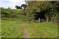
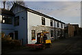
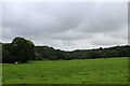
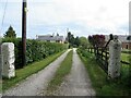
Photos of PR5 0RL


Area Information
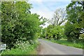
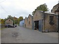
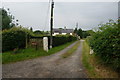
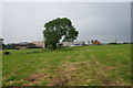
PR5 0RL is a compact residential cluster covering just 1.2 hectares. It forms a specific postcode area that holds a population of 1,187 people. This figure creates a living space of roughly 19 people per hectare when accounting for the building footprint and roads. The area sits within Lancashire in England, offering a low-density environment typical of smaller settlements. You will find houses scattered across this small footprint rather than high-rise blocks or terraced rows. Daily life here revolves around a quiet, intimate setting where neighbours are likely to know each other. The low population density of 59 people per square kilometre ensures a calm atmosphere away from major urban congestion. For those seeking a home in PR5 0RL, the scale of this community provides a manageable routine without the noise of a larger town centre. It is an area defined by its modest size and stable resident base.
- Area Type
- Postcode
- Area Size
- 1.2 hectares
- Population
- 1187
- Population Density
- 59 people/km²
Homes in PR5 0RL are characterised by a predominantly owner-occupied market structure. The data shows that 84 per cent of residents own their accommodation, leaving only a small minority as renters. This pattern indicates a stable housing stock where families have remained in their properties for significant periods. The area consists mainly of houses, which aligns with the high ownership rate as single-family dwellings are generally more suited to owner-occupation than rental flats. For buyers looking at this small area, the primary challenge may be finding a house that meets your specific needs rather than browsing a diverse mix of property types. The low total population of 1,187 means the overall housing supply is limited. This scarcity can drive competition for the available stock. When purchasing a home in this postcode, you are entering an established market where ownership is the norm. The low density further suggests that new large-scale developments are unlikely to alter the character of the neighbourhood.
House Prices in PR5 0RL
Showing 4 properties
| Address | Type | Beds | Baths | Last Sale Price | Last Sale Date | |
|---|---|---|---|---|---|---|
| 6, Mayfield Terrace, Goosefoot Lane, Samlesbury, PR5 0RL | Terraced | 3 | 1 | £123,000 | Dec 2024 | |
| 8, Mayfield Terrace, Goosefoot Lane, Samlesbury, PR5 0RL | Terraced | - | - | £143,000 | Sep 2002 | |
| 2, Mayfield Terrace, Goosefoot Lane, Samlesbury, PR5 0RL | Cottage | 3 | 1 | £88,000 | Dec 2001 | |
| 4, Mayfield Terrace, Goosefoot Lane, Samlesbury, PR5 0RL | house | 3 | - | - | - |
Energy Efficiency in PR5 0RL
Daily life in PR5 0RL benefits from convenient access to local retail and transport hubs. There are five Spar stores listed as the notable retail amenities within practical reach. You can find essentials and groceries in these outlets without needing to travel far for basic shopping. Transport options are robust, with five railway stations accessible nearby. Pleasington Railway Station, Cherry Tree Railway Station, and Mill Hill Railway Station serve the surrounding network. These stations allow residents to connect to broader regional services. While the area itself is small at 1.2 hectares, the proximity of these stations integrates you into the wider Lancashire transport grid. The combination of nearby shops and rail links ensures you do not need a car for every task. Trade-offs exist, as the area is not a leisure destination itself but relies on these satellite amenities. You will need to travel slightly to dine out or visit entertainment venues outside the immediate neighbourhood.
Amenities
Schools
Families living in PR5 0RL have access to local education facilities nearby. The primary option for school-age children is Samlesbury Church of England School. This institution is rated good by Ofsted inspectors. The presence of a single primary school within the immediate vicinity suggests a limited choice for local families compared to larger towns. There are no secondary schools listed in the data for this specific postcode, meaning older students likely require transport to other centres. For parents prioritising education, Samlesbury Church of England School offers a state-assessed quality environment. The rating of good provides confidence in the academic standards of the local provider. While the area lacks a comprehensive school directly within its bounds, the nearby primary option serves the younger demographic well. You should plan commutes for older children if you require secondary education options not listed here.
| Rank | School | Type | Entry gender | Ages |
|---|
Explore more schools in this area
Go to Schools tabDemographics
The community in PR5 0RL is defined by a mature population profile. The median age stands at 47 years old, indicating a neighbourhood settled by long-term residents rather than students or young professionals. Most commonly, the area comprises adults between 30 and 64 years of age. This age distribution shapes the local culture toward stability and established family units or empty nesters. House ownership is extremely common, with 84 per cent of residents owning their homes outright or with a mortgage. This high rate suggests a settled community with strong local ties and minimal tenant turnover. The predominant ethnic group is white, reflecting a homogenous social fabric. You will find that the accommodation types are primarily houses, avoiding the mix of flats often found in urban districts. These factors combine to create a demographic environment focused on permanence and family life within the PR5 0RL boundaries.
Household Size
Accommodation Type
Tenure
Ethnic Group
Religion
Household Composition
Age
Household Deprivation
NS-SEC
Explore more demographic insights in this area
Go to Demographics tabPlanning
Planning Constraints
- Flood RiskPremium
- Ramsar Wetland SitesPremium
- Area of Outstanding Natural BeautyPremium
- Protected Nature ReservePremium
- Protected WoodlandPremium