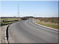
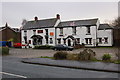
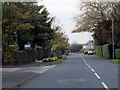
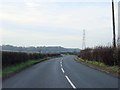
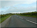
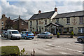
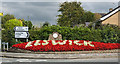
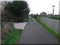
Area Overview for PR4 3XL
Photos of PR4 3XL
Area Information
Living in PR4 3XL means residing within a compact residential cluster covering exactly 6,112 square metres. This specific postcode serves approximately 1,625 residents, resulting in a population density of 182 people per square kilometre. The area is defined by its manageable size, creating a defined neighbourhood where daily routines rely on local accessibility rather than extensive travel. You find yourself in a settled environment where the built space directly supports the community living here. The physical footprint suggests an area designed for density without urban sprawl, making it a distinct choice for those prioritising proximity to amenities and a contained sense of place. Daily life centres on the immediate surroundings, as the small geographic area concentrates residential activity. This layout fosters a community where neighbours are naturally close, and the distance between homes and services remains short.
- Area Type
- Postcode
- Area Size
- 6112 m²
- Population
- 1625
- Population Density
- 182 people/km²
The housing stock in PR4 3XL is almost entirely composed of houses, distinguishing it from areas dominated by flats or apartments. With an 87 per cent home ownership rate, this postcode functions primarily as an owner-occupied market rather than a rental sector. Buyers looking at homes in PR4 3XL should expect a landscape of established family properties rather than new-build developments or investment rentals. The nature of the accommodation points to a market where purchasers seek to live permanently rather than rent transiently. This high level of ownership often results in more careful maintenance of the existing housing stock and stable neighbourhood governance. For those considering houses in this specific area, the market reflects a demand for security and established tenure. The residential cluster remains a desirable location for individuals or families seeking to put down roots in a defined environment without the complexities of mixed-use buildings or high-density rental blocks.
House Prices in PR4 3XL
Showing 20 properties
| Address | Type | Beds | Baths | Last Sale Price | Last Sale Date | |
|---|---|---|---|---|---|---|
| 16 Wilson Drive, Elswick, PR4 3XL | Semi-detached | 3 | 1 | £185,000 | May 2023 | |
| 24 Wilson Drive, Elswick, PR4 3XL | house | - | - | £197,500 | Dec 2022 | |
| 12 Wilson Drive, Elswick, PR4 3XL | house | - | - | £180,000 | Feb 2022 | |
| 10 Wilson Drive, Elswick, PR4 3XL | house | 3 | 1 | £161,000 | Mar 2020 | |
| 6 Wilson Drive, Elswick, PR4 3XL | house | - | - | £149,950 | Aug 2011 | |
| 11 Wilson Drive, Elswick, PR4 3XL | Bungalow | - | - | £170,500 | Nov 2009 | |
| 2 Wilson Drive, Elswick, PR4 3XL | Semi-detached | 3 | - | £169,950 | Mar 2008 | |
| 13 Wilson Drive, Elswick, PR4 3XL | Semi-detached | - | - | £182,000 | Dec 2007 | |
| 15 Wilson Drive, Elswick, PR4 3XL | Semi-detached | - | - | £180,000 | May 2006 | |
| 1 Wilson Drive, Elswick, PR4 3XL | Semi-detached | - | - | £165,000 | Dec 2005 |
Energy Efficiency in PR4 3XL
Residents of PR4 3XL benefit from a concise selection of amenities located within practical reach. The retail landscape includes three Spar outlets and Aldi Kirkham, providing essential shopping and fresh produce straight away. For those who prefer specific ranges, these stores are firmly established staples of the local high street. Transport links are accessible via five notable rail stations, which serve the wider region effectively. Poulton Railway Station, Kirkham & Wesham Railway Station, and Salwick Railway Station fall within this immediate vicinity. These stations offer connectivity to broader networks without requiring a lengthy drive. The combination of multiple Spar branches and a major supermarket like Aldi Kirkham means you handle most shopping needs without leaving the immediate neighbourhood. This convenience factor adds significant value to daily life, allowing you to manage groceries and essentials efficiently. The rail infrastructure further reduces dependence on car journeys for commuting or leisure travel.
Amenities
Schools
| Rank | School | Type | Entry gender | Ages |
|---|
Explore more schools in this area
Go to Schools tabDemographics
The community in PR4 3XL features a mature demographic profile, with a median age of 47 years. Adults aged between 30 and 64 years represent the most common age range within this population. Home ownership stands at 87 per cent, indicating that the vast majority of households in this postcode possess freehold or leasehold title to their properties. Nearly two-thirds of the local accommodation consists of houses, reflecting a preference for detached or semi-detached living over flats or apartments. The predominant ethnic group identified is White, aligning with traditional settlement patterns in this region. These figures paint a picture of a stable, established neighbourhood where long-term residents hold a strong stake in the locality. The high rate of ownership suggests a community less driven by short-term rental speculation. Residents here likely prioritise stability and have been part of this specific stretch of PR4 3XL for many years.
Household Size
Accommodation Type
Tenure
Ethnic Group
Religion
Household Composition
Age
Household Deprivation
NS-SEC
Explore more demographic insights in this area
Go to Demographics tabPlanning
Planning Constraints
- Flood RiskPremium
- Ramsar Wetland SitesPremium
- Area of Outstanding Natural BeautyPremium
- Protected Nature ReservePremium
- Protected WoodlandPremium