Area Overview for PR4 3UQ
Photos of PR4 3UQ
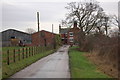
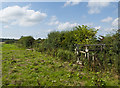
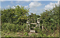
3 photos from this area
Area Information
Key information about the PR4 3UQ including its size, population, and administrative classification.
- Area Type
- Postcode
- Area Size
- 13.1 hectares
- Population
- 1625
- Population Density
- 182 people/km²
House Prices in PR4 3UQ
30
Properties
£151,983
Average Sold Price
£63,000
Lowest Price
£240,000
Highest Price
Showing 30 properties
| Address | Type | Beds | Baths | Last Sale Price | Last Sale Date | |
|---|---|---|---|---|---|---|
| 40 Roseacre Drive, Elswick, PR4 3UQ | Semi-detached | 3 | 2 | £215,000 | Nov 2022 | |
| 34 Roseacre Drive, Elswick, PR4 3UQ | house | - | - | £225,000 | Sep 2021 | |
| 24 Roseacre Drive, Elswick, PR4 3UQ | Semi-detached | 3 | 1 | £150,000 | Nov 2019 | |
| 38 Roseacre Drive, Elswick, PR4 3UQ | Bungalow | - | - | £170,000 | Oct 2019 | |
| 55 Roseacre Drive, Elswick, PR4 3UQ | Semi-detached | 3 | 2 | £196,000 | Sep 2019 | |
| 32 Roseacre Drive, Elswick, PR4 3UQ | Semi-detached | 3 | 2 | £181,500 | Jul 2018 | |
| 67 Roseacre Drive, Elswick, PR4 3UQ | Bungalow | 3 | - | £184,000 | Dec 2015 | |
| 57 Roseacre Drive, Elswick, PR4 3UQ | Bungalow | - | - | £160,000 | May 2014 | |
| 45 Roseacre Drive, Elswick, PR4 3UQ | house | - | - | £240,000 | Feb 2014 | |
| 73 Roseacre Drive, Elswick, PR4 3UQ | Detached | 4 | 1 | £220,000 | Aug 2009 |
Page 1 of 3
Energy Efficiency in PR4 3UQ
Amenities
Schools
| Rank | School | Type | Entry gender | Ages |
|---|
Explore more schools in this area
Go to Schools tabDemographics
Household Size
Two person
most common
Accommodation Type
Houses
most common
Tenure
87
majority
Ethnic Group
White
most common
Religion
N/A
most common
Household Composition
N/A
most common
Age
47
median
Adults (30-64 years)
most common
Household Deprivation
N/A
with no deprivation
NS-SEC
43
in Lower managerial occupations
Explore more demographic insights in this area
Go to Demographics tabPlanning
Planning Constraints
- Flood RiskPremium
- Ramsar Wetland SitesPremium
- Area of Outstanding Natural BeautyPremium
- Protected Nature ReservePremium
- Protected WoodlandPremium