Area Overview for PR4 3ES
Photos of PR4 3ES
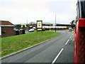

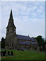
![Station Road [B1592], Wesham in PR4 3ES](https://images.propbar.co.uk/images/geograph/46/88/4688294_120.jpg)
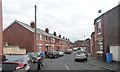
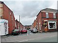
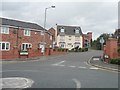
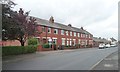
54 photos from this area
Area Information
Key information about the PR4 3ES including its size, population, and administrative classification.
- Area Type
- Postcode
- Area Size
- 1.3 hectares
- Population
- 1715
- Population Density
- 3971 people/km²
House Prices in PR4 3ES
27
Properties
£190,400
Average Sold Price
£52,500
Lowest Price
£399,950
Highest Price
Showing 27 properties
| Address | Type | Beds | Baths | Last Sale Price | Last Sale Date | |
|---|---|---|---|---|---|---|
| 9 Hornbeam Close, Medlar With Wesham, PR4 3ES | Semi-detached | 4 | 1 | £156,500 | Apr 2024 | |
| 1 Hornbeam Close, Medlar With Wesham, PR4 3ES | Semi-detached | 3 | 2 | £153,000 | Dec 2020 | |
| 20 Hornbeam Close, Medlar With Wesham, PR4 3ES | Terraced | - | - | £111,000 | Feb 2020 | |
| 28 Hornbeam Close, Medlar With Wesham, PR4 3ES | Terraced | 3 | 1 | £72,500 | Aug 2015 | |
| 26 Hornbeam Close, Medlar With Wesham, PR4 3ES | Terraced | - | - | £52,500 | Sep 2013 | |
| 2 Hornbeam Close, Medlar With Wesham, PR4 3ES | Detached | - | - | £249,950 | Sep 2009 | |
| 23 Hornbeam Close, Medlar With Wesham, PR4 3ES | Semi-detached | 4 | 1 | £189,950 | Jun 2009 | |
| 10 Hornbeam Close, Medlar With Wesham, PR4 3ES | Detached | - | - | £399,950 | Feb 2009 | |
| 8 Hornbeam Close, Medlar With Wesham, PR4 3ES | Detached | 5 | 3 | £319,950 | Dec 2008 | |
| 3 Hornbeam Close, Medlar With Wesham, PR4 3ES | Semi-detached | 3 | 2 | £164,950 | Dec 2008 |
Page 1 of 3
Energy Efficiency in PR4 3ES
Amenities
Schools
| Rank | School | Type | Entry gender | Ages |
|---|
Explore more schools in this area
Go to Schools tabDemographics
Household Size
One person
most common
Accommodation Type
Houses
most common
Tenure
50
majority
Ethnic Group
White
most common
Religion
N/A
most common
Household Composition
N/A
most common
Age
47
median
Adults (30-64 years)
most common
Household Deprivation
N/A
with no deprivation
NS-SEC
27
in Lower managerial occupations
Explore more demographic insights in this area
Go to Demographics tabPlanning
Planning Constraints
- Flood RiskPremium
- Ramsar Wetland SitesPremium
- Area of Outstanding Natural BeautyPremium
- Protected Nature ReservePremium
- Protected WoodlandPremium