Area Overview for PR4 3AD
Photos of PR4 3AD
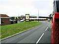


![Station Road [B1592], Wesham in PR4 3AD](https://images.propbar.co.uk/images/geograph/46/88/4688294_120.jpg)


54 photos from this area
Area Information
Key information about the PR4 3AD including its size, population, and administrative classification.
- Area Type
- Postcode
- Area Size
- 4090 m²
- Population
- 1715
- Population Density
- 3971 people/km²
House Prices in PR4 3AD
31
Properties
£77,643
Average Sold Price
£35,000
Lowest Price
£135,000
Highest Price
Showing 31 properties
| Address | Type | Beds | Baths | Last Sale Price | Last Sale Date | |
|---|---|---|---|---|---|---|
| 18 Station Road, Medlar With Wesham, PR4 3AD | Terraced | 4 | 1 | £135,000 | Feb 2022 | |
| 20 Station Road, Kirkham, PR4 3AD | Terraced | 4 | 2 | £113,000 | Feb 2020 | |
| 32 Station Road, Medlar With Wesham, PR4 3AD | Terraced | 2 | 1 | £93,500 | Oct 2016 | |
| 26 Station Road, Medlar With Wesham, PR4 3AD | Terraced | 3 | 1 | £63,000 | Jul 2009 | |
| Ground Floor Flat, 34 Station Road, Medlar With Wesham, PR4 3AD | Flat | 2 | 2 | £42,000 | Aug 2004 | |
| 28 Station Road, Medlar With Wesham, PR4 3AD | house | - | - | £62,000 | May 2003 | |
| 46A Station Road, Medlar With Wesham, PR4 3AD | Flat | 2 | 1 | £35,000 | Jun 2002 | |
| Flat B, 42 Station Road, Medlar With Wesham, PR4 3AD | Flat | 3 | 1 | - | - | |
| 30A Station Road, Medlar With Wesham, PR4 3AD | Flat | - | - | - | - | |
| First Floor Flat, 14 Station Road, Medlar With Wesham, PR4 3AD | Flat | - | - | - | - |
Page 1 of 4
Energy Efficiency in PR4 3AD
Amenities
Schools
| Rank | School | Type | Entry gender | Ages |
|---|
Explore more schools in this area
Go to Schools tabDemographics
Household Size
One person
most common
Accommodation Type
Houses
most common
Tenure
50
majority
Ethnic Group
White
most common
Religion
N/A
most common
Household Composition
N/A
most common
Age
47
median
Adults (30-64 years)
most common
Household Deprivation
N/A
with no deprivation
NS-SEC
27
in Lower managerial occupations
Explore more demographic insights in this area
Go to Demographics tabPlanning
Planning Constraints
- Flood RiskPremium
- Ramsar Wetland SitesPremium
- Area of Outstanding Natural BeautyPremium
- Protected Nature ReservePremium
- Protected WoodlandPremium