Area Overview for PR4 0LH
Photos of PR4 0LH
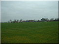


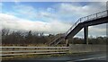
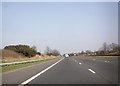

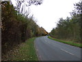
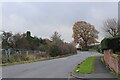

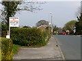
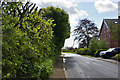
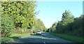
12 photos from this area
Area Information
Key information about the PR4 0LH including its size, population, and administrative classification.
- Area Type
- Postcode
- Area Size
- 70.3 hectares
- Population
- 2537
- Population Density
- 1347 people/km²
House Prices in PR4 0LH
51
Properties
£300,799
Average Sold Price
£78,500
Lowest Price
£700,000
Highest Price
Showing 51 properties
| Address | Type | Beds | Baths | Last Sale Price | Last Sale Date | |
|---|---|---|---|---|---|---|
| Turner House, Tabley Lane, Preston, PR4 0LH | Detached | 5 | 4 | £700,000 | Mar 2025 | |
| Cherryleigh, Tabley Lane, Preston, PR4 0LH | Bungalow | 5 | 3 | £414,000 | Dec 2024 | |
| 15 Tabley Lane, Preston, PR4 0LH | Terraced | 3 | 2 | £170,000 | Jun 2024 | |
| 17 Tabley Lane, Preston, PR4 0LH | Semi-detached | 3 | 2 | £228,500 | Apr 2024 | |
| 10 Tabley Lane, Preston, PR4 0LH | house | - | - | £529,995 | Jan 2023 | |
| Pendle View Barn, Tabley Lane, Preston, PR4 0LH | house | - | - | £680,000 | Apr 2022 | |
| Smithy House, Tabley Lane, Preston, PR4 0LH | Detached | 5 | 3 | £315,000 | May 2021 | |
| Hautmont, Tabley Lane, Preston, PR4 0LH | Detached | 4 | 2 | £479,000 | Apr 2020 | |
| Brookley Barn, Tabley Lane, Preston, PR4 0LH | Semi-detached | 6 | 4 | £590,000 | Dec 2018 | |
| 21 Tabley Lane, Preston, PR4 0LH | house | - | - | £189,995 | Apr 2018 |
Page 1 of 6
Energy Efficiency in PR4 0LH
Amenities
Schools
| Rank | School | Type | Entry gender | Ages |
|---|
Explore more schools in this area
Go to Schools tabDemographics
Household Size
Family (3-5 people)
most common
Accommodation Type
Houses
most common
Tenure
90
majority
Ethnic Group
White
most common
Religion
N/A
most common
Household Composition
N/A
most common
Age
47
median
Adults (30-64 years)
most common
Household Deprivation
N/A
with no deprivation
NS-SEC
52
in Lower managerial occupations
Explore more demographic insights in this area
Go to Demographics tabPlanning
Planning Constraints
- Flood RiskPremium
- Ramsar Wetland SitesPremium
- Area of Outstanding Natural BeautyPremium
- Protected Nature ReservePremium
- Protected WoodlandPremium