Area Overview for PR4 0LB
Photos of PR4 0LB
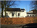
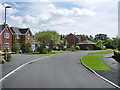
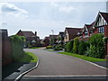
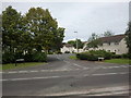
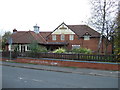


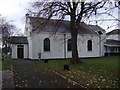
18 photos from this area
Area Information
Key information about the PR4 0LB including its size, population, and administrative classification.
- Area Type
- Postcode
- Area Size
- 2.1 hectares
- Population
- 2537
- Population Density
- 1347 people/km²
House Prices in PR4 0LB
30
Properties
£233,450
Average Sold Price
£3,600
Lowest Price
£485,000
Highest Price
Showing 30 properties
| Address | Type | Beds | Baths | Last Sale Price | Last Sale Date | |
|---|---|---|---|---|---|---|
| 73 Hoyles Lane, Preston, PR4 0LB | Detached | 3 | 2 | £385,000 | Mar 2025 | |
| 25 Hoyles Lane, Preston, PR4 0LB | Detached | 4 | 2 | £390,000 | Sep 2022 | |
| 71 Hoyles Lane, Preston, PR4 0LB | Detached | 4 | 3 | £485,000 | Sep 2021 | |
| 63 Hoyles Lane, Preston, PR4 0LB | house | - | - | £3,600 | Nov 2020 | |
| 11 Hoyles Lane, Preston, PR4 0LB | Semi-detached | 3 | 2 | £205,000 | Aug 2020 | |
| 85 Hoyles Lane, Preston, PR4 0LB | Detached | 4 | 2 | £423,000 | Oct 2018 | |
| 7 Hoyles Lane, Preston, PR4 0LB | Semi-detached | - | - | £265,000 | Apr 2018 | |
| 59 Hoyles Lane, Preston, PR4 0LB | Detached | 2 | 1 | £305,000 | Feb 2016 | |
| 77 Hoyles Lane, Preston, PR4 0LB | house | - | - | £280,000 | Jun 2012 | |
| 19 Hoyles Lane, Preston, PR4 0LB | Retail | 5 | 2 | £355,000 | Apr 2012 |
Page 1 of 3
Energy Efficiency in PR4 0LB
Amenities
Schools
| Rank | School | Type | Entry gender | Ages |
|---|
Explore more schools in this area
Go to Schools tabDemographics
Household Size
Family (3-5 people)
most common
Accommodation Type
Houses
most common
Tenure
90
majority
Ethnic Group
White
most common
Religion
N/A
most common
Household Composition
N/A
most common
Age
47
median
Adults (30-64 years)
most common
Household Deprivation
N/A
with no deprivation
NS-SEC
52
in Lower managerial occupations
Explore more demographic insights in this area
Go to Demographics tabPlanning
Planning Constraints
- Flood RiskPremium
- Ramsar Wetland SitesPremium
- Area of Outstanding Natural BeautyPremium
- Protected Nature ReservePremium
- Protected WoodlandPremium