Area Overview for PR4 0LA
Photos of PR4 0LA
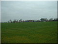


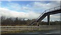
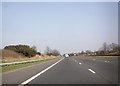

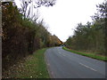
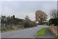
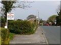
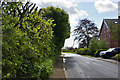
12 photos from this area
Area Information
Key information about the PR4 0LA including its size, population, and administrative classification.
- Area Type
- Postcode
- Area Size
- 3.1 hectares
- Population
- 2537
- Population Density
- 1347 people/km²
House Prices in PR4 0LA
47
Properties
£276,840
Average Sold Price
£72,500
Lowest Price
£575,000
Highest Price
Showing 47 properties
| Address | Type | Beds | Baths | Last Sale Price | Last Sale Date | |
|---|---|---|---|---|---|---|
| 210 Lightfoot Lane, Preston, PR4 0LA | Detached | 3 | 2 | £325,000 | Dec 2025 | |
| 250 Lightfoot Lane, Preston, PR4 0LA | Detached | 3 | 3 | £575,000 | Nov 2025 | |
| Daisy Cottage, 155 Lightfoot Lane, Preston, PR4 0LA | Retail | 3 | - | £270,000 | Jul 2022 | |
| Lagonda, 242 Lightfoot Lane, Preston, PR4 0LA | Bungalow | 3 | 2 | £265,000 | Sep 2021 | |
| Thorpe Lodge, 147A Lightfoot Lane, Preston, PR4 0LA | Detached | 4 | 2 | £480,000 | Jul 2021 | |
| Ivanho, 230 Lightfoot Lane, Preston, PR4 0LA | house | - | - | £180,000 | Jul 2021 | |
| 252 Lightfoot Lane, Preston, PR4 0LA | Detached | - | - | £150,000 | Jun 2020 | |
| 181 Lightfoot Lane, Preston, PR4 0LA | Detached | 3 | 1 | £208,000 | Apr 2017 | |
| 208 Lightfoot Lane, Preston, PR4 0LA | Detached | - | - | £317,995 | Nov 2015 | |
| Thorntree Farm, Lightfoot Lane, Preston, PR4 0LA | Detached | 5 | 2 | £325,000 | Nov 2014 |
Page 1 of 5
Energy Efficiency in PR4 0LA
Amenities
Schools
| Rank | School | Type | Entry gender | Ages |
|---|
Explore more schools in this area
Go to Schools tabDemographics
Household Size
Family (3-5 people)
most common
Accommodation Type
Houses
most common
Tenure
90
majority
Ethnic Group
White
most common
Religion
N/A
most common
Household Composition
N/A
most common
Age
47
median
Adults (30-64 years)
most common
Household Deprivation
N/A
with no deprivation
NS-SEC
52
in Lower managerial occupations
Explore more demographic insights in this area
Go to Demographics tabPlanning
Planning Constraints
- Flood RiskPremium
- Ramsar Wetland SitesPremium
- Area of Outstanding Natural BeautyPremium
- Protected Nature ReservePremium
- Protected WoodlandPremium