Area Overview for PR3 6AJ
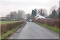
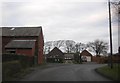
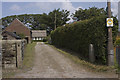
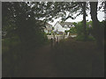
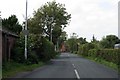
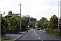
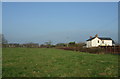
Photos of PR3 6AJ


Area Information
Living in PR3 6AJ means residing within a specific residential cluster defined by the postcode PR3 6AJ. This small pocket covers an area of 1235 square metres, holding a population of 2628 people. The density stands at 75 people per square kilometre, creating a relatively low-density neighbourhood. You are situated in a setting that prioritises detached living over high-rise blocks, given the structure of the households here. The landscape supports a population that values space and a quieter domestic environment. This specific cluster forms part of a larger residential tapestry in the region, offering a settled feel without the congestion of a high-density urban core. Residents here navigate daily life in an environment that balances suburban convenience with distinct local character. The area serves as a compact community hub where the distance between neighbours is measured in blocks rather than miles. Your immediate surroundings are designed for a lifestyle that includes access to local transport links and nearby facilities without the pressure of a city centre. The physical confines of the postcode area shape a tight-knit community atmosphere where the 2628 residents share common local amenities and services. Understanding the scale of 1235 square metres helps you grasp the spatial organisation of this specific residential zone. You benefit from a layout that reduces travel times for local errands while maintaining a sense of privacy. The data confirms a stable residential footprint where the majority of occupants have established roots in this specific location.
- Area Type
- Postcode
- Area Size
- 1235 m²
- Population
- 2628
- Population Density
- 75 people/km²
The property market in PR3 6AJ is defined by a distinct lack of rental homeownership, with 82% of dwellings held by owner-occupiers. This figure stands in stark contrast to areas where investment properties or shared ownership schemes dominate the scene. The accommodation type is exclusively houses, meaning you will find detached, semi-detached, and terraced housing but no flats or apartments within this specific cluster. This composition creates a market where buyers look for permanent residences rather than short-term lets. When considering homes in PR3 6AJ, you enter a market where sellers are often residents seeking to upgrade or downsize rather than landlords wishing to cash out quickly. The 82% ownership rate signals a steady market driven by genuine living needs and long-term financial planning. You can expect pricing structures that reflect the value of established neighbourhoods with deep-rooted communities. The housing stock consistency ensures that homes in PR3 6AJ share similar structural characteristics, simplifying comparisons for potential purchasers. Buyers here often value the privacy and space that house-only estates provide over the apartment living options available elsewhere. The market dynamics favour those who can secure mortgage financing for traditional house purchases rather than those seeking rental flexibility. This area attracts families and individuals who prioritise the stability of owning a freehold or leasehold house. The high ownership percentage suggests that local improvements and estate maintenance are funded primarily through council tax rather than ground rents. You are participating in a market where community sentiment and local pride often drive property values. The uniformity of house types reduces the risk of unexpected structural contrasts when viewing properties in this postcode area.
House Prices in PR3 6AJ
Showing 1 properties
| Address | Type | Beds | Baths | Last Sale Price | Last Sale Date | |
|---|---|---|---|---|---|---|
| Wyresdale Garden Concrete Prod, Old Station Yard, Bradshaw Lane, Pilling, PR3 6AJ | Industrial | - | - | - | - |
Energy Efficiency in PR3 6AJ
Daily life in PR3 6AJ centres on a practical range of nearby amenities that serve essential needs without requiring long journeys. Residents have access to five retail outlets, including Morrisons Daily Poulton, Co-op Preesall, and Co-op Knott within practical reach. These venues provide routine grocery shopping and convenience services directly integrated into your weekly routine. For travel enthusiasts, two ferry terminals operate nearby, including the Fleetwood for Knott End Ferry Landing. This link offers a direct maritime connection to the mainland from Knott End. You can reach the ferry infrastructure effortlessly, avoiding the uncertainty of road traffic on major routes. The area also features five metro stations, including Victoria Street and London Street, facilitating regional train travel. These stations connect you to wider networks while remaining steps away from local streets. Your lifestyle includes a mix of community shopping and transport-focused leisure. The presence of multiple supermarkets ensures you never lack for essential household provisions. The ferry terminals add a unique dimension to local leisure, offering easy escapes to the seaside. You can plan journeys to the coast with minimal planning. The metro stations handle passenger flow efficiently, keeping local travel times predictable. This combination of retail and transport hubs makes PR3 6AJ a convenient base for regional exploration. The specific locations of Morrisons, Co-op stores, and the ferry landing anchor your daily commute patterns in reliability.
Amenities
Schools
Families living in PR3 6AJ have access to a strong selection of primary education options within practical reach. Winmarleigh Church of England Primary School holds a good Ofsted rating and serves as a reputable choice for your children. Pilling St John's Church of England Voluntary Aided Primary School also carries a good Ofsted rating, adding another high-quality option to your list. St William's Catholic Primary School, Pilling, provides a third state-funded primary education route for residents in this cluster. For those seeking alternative education pathways, Springfield House School offers private instruction with a good Ofsted rating. This mix of state-funded Church of England voluntary aided schools and private independent provision allows parents to choose based on religious affiliation or specific pedagogical approaches. You benefit from having three state primary schools rated good or suitable alongside one private institution. The presence of multiple options reduces competition for places and increases the likelihood of securing a preferred school setting. Education in this area is robust, with no gaps in provision for the local age group. When you look at schools near PR3 6AJ, you see an establishment focused on core academic standards and religious education. The independent school nearby reflects a community that values diverse educational outcomes. Your children can access well-regarded learning environments without travelling far from home. The variety ensures that whether you prefer a maintained school or an private academy, quality instruction remains available.
| Rank | School | Type | Entry gender | Ages |
|---|
Explore more schools in this area
Go to Schools tabDemographics
The community in PR3 6AJ reflects a mature population centre with a median age of 47 years. Most residents fall into the adult age range of 30 to 64 years, shaping a neighbourhood dominated by working families and established professionals. Home ownership is extremely high, with 82% of properties occupied by owners rather than tenants. This statistic indicates a stable, long-term community where residents have invested directly in their local environment. The predominant accommodation type consists of houses, distinguishing this cluster from estates of flats or apartments found in larger urban centres. Ethnic diversity centres around a White population, reflecting the broader demographic trends of the wider region. You are joining a community where household structures traditional and family-oriented housing solutions dominate the landscape. The age profile suggests that local primary schools remain relevant for a significant portion of the population, particularly those with young children. Your neighbours likely include someone from the 30 to 64 year bracket who understands the practicalities of running a household in this specific postcode sector. The high ownership rate of 82% means that decisions about local improvements and community cohesion often come from a base of permanent residents. This groups creates an environment where property values and maintenance standards tend to reflect owner investment. The housing stock is exclusively composed of houses, eliminating the variance found in mixed-use developments. You can expect a demographic landscape where generational stability is the norm rather than the exception. The median age of 47 ensures that local governance and community initiatives often cater to the needs of adults with established careers and families.
Household Size
Accommodation Type
Tenure
Ethnic Group
Religion
Household Composition
Age
Household Deprivation
NS-SEC
Explore more demographic insights in this area
Go to Demographics tabPlanning
Planning Constraints
- Flood RiskPremium
- Ramsar Wetland SitesPremium
- Area of Outstanding Natural BeautyPremium
- Protected Nature ReservePremium
- Protected WoodlandPremium