Area Overview for PR3 6AE
Photos of PR3 6AE
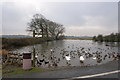
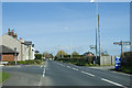
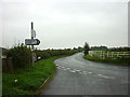
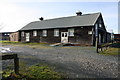
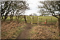
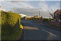
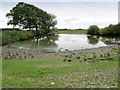
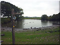
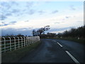
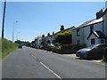
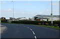
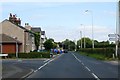
17 photos from this area
Area Information
Key information about the PR3 6AE including its size, population, and administrative classification.
- Area Type
- Postcode
- Area Size
- 18.4 hectares
- Population
- 2628
- Population Density
- 75 people/km²
House Prices in PR3 6AE
51
Properties
£191,708
Average Sold Price
£51,000
Lowest Price
£357,000
Highest Price
Showing 51 properties
| Address | Type | Beds | Baths | Last Sale Price | Last Sale Date | |
|---|---|---|---|---|---|---|
| St Johns Vicarage, Lancaster Road, Pilling, PR3 6AE | Detached | 4 | 1 | £357,000 | Apr 2025 | |
| Goodwood, Lancaster Road, Pilling, PR3 6AE | Bungalow | 3 | 1 | £240,000 | Dec 2022 | |
| Meadowcroft, Lancaster Road, Pilling, PR3 6AE | Bungalow | 3 | 1 | £225,000 | Feb 2022 | |
| Holly Cottage, Lancaster Road, Pilling, PR3 6AE | house | - | - | £164,995 | Feb 2022 | |
| Lingfield, Lancaster Road, Pilling, PR3 6AE | Bungalow | 3 | 1 | £275,000 | Jun 2021 | |
| The Gables, Lancaster Road, Pilling, PR3 6AE | Detached | 4 | 3 | £300,000 | Nov 2020 | |
| Greenfields, Lancaster Road, Pilling, PR3 6AE | Bungalow | 3 | 2 | £220,000 | Jul 2020 | |
| Grasscroft, Lancaster Road, Pilling, PR3 6AE | Detached | 4 | 1 | £192,780 | Nov 2019 | |
| Fern Cottage, Lancaster Road, Pilling, PR3 6AE | Semi-detached | 3 | 2 | £170,000 | Jul 2018 | |
| Ling Cottage, Lancaster Road, Pilling, PR3 6AE | Semi-detached | - | - | £160,000 | Jul 2014 |
Page 1 of 6
Energy Efficiency in PR3 6AE
Amenities
Schools
| Rank | School | Type | Entry gender | Ages |
|---|
Explore more schools in this area
Go to Schools tabDemographics
Household Size
Two person
most common
Accommodation Type
Houses
most common
Tenure
82
majority
Ethnic Group
White
most common
Religion
N/A
most common
Household Composition
N/A
most common
Age
47
median
Adults (30-64 years)
most common
Household Deprivation
N/A
with no deprivation
NS-SEC
34
in Lower managerial occupations
Explore more demographic insights in this area
Go to Demographics tabPlanning
Planning Constraints
- Flood RiskPremium
- Ramsar Wetland SitesPremium
- Area of Outstanding Natural BeautyPremium
- Protected Nature ReservePremium
- Protected WoodlandPremium