Area Overview for PR2 6SQ
Photos of PR2 6SQ
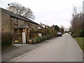
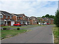
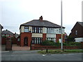
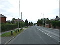
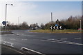
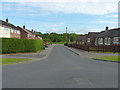
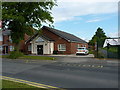
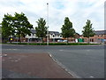
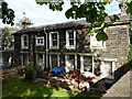
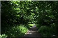
34 photos from this area
Area Information
Key information about the PR2 6SQ including its size, population, and administrative classification.
- Area Type
- Postcode
- Area Size
- 1.3 hectares
- Population
- 1546
- Population Density
- 1924 people/km²
House Prices in PR2 6SQ
45
Properties
£85,814
Average Sold Price
£19,000
Lowest Price
£161,000
Highest Price
Showing 45 properties
| Address | Type | Beds | Baths | Last Sale Price | Last Sale Date | |
|---|---|---|---|---|---|---|
| 10 Oakworth Avenue, Preston, PR2 6SQ | Terraced | 3 | 1 | £161,000 | Oct 2025 | |
| 45 Oakworth Avenue, Preston, PR2 6SQ | Terraced | 3 | 1 | £100,000 | Mar 2025 | |
| 49 Oakworth Avenue, Preston, PR2 6SQ | Terraced | 3 | 1 | £118,000 | Apr 2023 | |
| 6 Oakworth Avenue, Preston, PR2 6SQ | Terraced | 3 | 1 | £105,000 | Aug 2022 | |
| 33 Oakworth Avenue, Preston, PR2 6SQ | Terraced | 3 | 1 | £115,000 | Sep 2021 | |
| 24 Oakworth Avenue, Preston, PR2 6SQ | Terraced | 3 | 1 | £114,000 | Jan 2020 | |
| 29 Oakworth Avenue, Preston, PR2 6SQ | house | 3 | - | £81,000 | Oct 2019 | |
| 15 Oakworth Avenue, Preston, PR2 6SQ | house | 4 | 2 | £108,000 | Mar 2019 | |
| 31 Oakworth Avenue, Preston, PR2 6SQ | house | 3 | - | £69,950 | Mar 2017 | |
| 30 Oakworth Avenue, Preston, PR2 6SQ | Terraced | 3 | 1 | £94,000 | Apr 2016 |
Page 1 of 5
Energy Efficiency in PR2 6SQ
Amenities
Schools
| Rank | School | Type | Entry gender | Ages |
|---|
Explore more schools in this area
Go to Schools tabDemographics
Household Size
Family (3-5 people)
most common
Accommodation Type
Houses
most common
Tenure
64
majority
Ethnic Group
White
most common
Religion
N/A
most common
Household Composition
N/A
most common
Age
47
median
Adults (30-64 years)
most common
Household Deprivation
N/A
with no deprivation
NS-SEC
26
in Lower managerial occupations
Explore more demographic insights in this area
Go to Demographics tabPlanning
Planning Constraints
- Flood RiskPremium
- Ramsar Wetland SitesPremium
- Area of Outstanding Natural BeautyPremium
- Protected Nature ReservePremium
- Protected WoodlandPremium