Area Overview for PR2 6SJ
Photos of PR2 6SJ
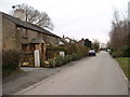
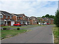
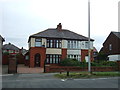
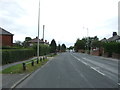
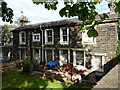

34 photos from this area
Area Information
Key information about the PR2 6SJ including its size, population, and administrative classification.
- Area Type
- Postcode
- Area Size
- 2.3 hectares
- Population
- 1546
- Population Density
- 1924 people/km²
House Prices in PR2 6SJ
17
Properties
£120,472
Average Sold Price
£77,000
Lowest Price
£185,000
Highest Price
Showing 17 properties
| Address | Type | Beds | Baths | Last Sale Price | Last Sale Date | |
|---|---|---|---|---|---|---|
| 35 Gamull Lane, Preston, PR2 6SJ | house | 3 | 1 | £137,000 | Aug 2025 | |
| 33 Gamull Lane, Preston, PR2 6SJ | Terraced | 3 | 1 | £112,000 | Mar 2025 | |
| Station House, Gamull Lane, Preston, PR2 6SJ | house | - | - | £160,000 | Mar 2021 | |
| 31 Gamull Lane, Preston, PR2 6SJ | house | 2 | - | £95,000 | Dec 2020 | |
| 37 Gamull Lane, Preston, PR2 6SJ | Terraced | 3 | 1 | £107,000 | Aug 2020 | |
| 39 Gamull Lane, Preston, PR2 6SJ | house | - | - | £108,250 | Jul 2015 | |
| 30 Gamull Lane, Preston, PR2 6SJ | Bungalow | - | - | £185,000 | Sep 2013 | |
| 25 Gamull Lane, Preston, PR2 6SJ | Terraced | 3 | 1 | £77,000 | Apr 2011 | |
| 28 Gamull Lane, Preston, PR2 6SJ | Detached | - | - | £103,000 | Jan 2003 | |
| St Maria Goretti Presbytery, Gamull Lane, Preston, PR2 6SJ | house | - | - | - | - |
Page 1 of 2
Energy Efficiency in PR2 6SJ
Amenities
Schools
| Rank | School | Type | Entry gender | Ages |
|---|
Explore more schools in this area
Go to Schools tabDemographics
Household Size
Family (3-5 people)
most common
Accommodation Type
Houses
most common
Tenure
64
majority
Ethnic Group
White
most common
Religion
N/A
most common
Household Composition
N/A
most common
Age
47
median
Adults (30-64 years)
most common
Household Deprivation
N/A
with no deprivation
NS-SEC
26
in Lower managerial occupations
Explore more demographic insights in this area
Go to Demographics tabPlanning
Planning Constraints
- Flood RiskPremium
- Ramsar Wetland SitesPremium
- Area of Outstanding Natural BeautyPremium
- Protected Nature ReservePremium
- Protected WoodlandPremium