Area Overview for PR2 6PG
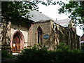
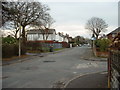
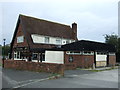
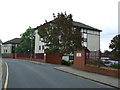
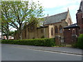
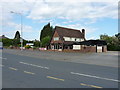
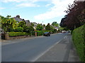
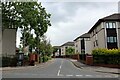
Photos of PR2 6PG
Area Information
Living in PR2 6PG offers a defined residential experience within a specific postcode cluster covering 4,065 square metres. This small area represents a home for 1,956 people, creating a densely populated neighbourhood on the outskirts of Preston. The high population density of 481,178 people per square kilometre reflects the proximity of these homes to surrounding urban centres while maintaining a clear residential boundary. You will find a community character shaped by its location and size, making it distinct from larger, more spread-out suburbs. Daily life here involves navigating a compact environment where local amenities and transport links play a crucial role in connectivity. The area serves as a practical base for those working in Preston or commuting via the nearby railway network. Residents benefit from being part of a specific housing cluster rather than a sprawling town centre, which often appeals to buyers seeking defined local estates. The lack of planning constraints such as protected woodlands or nature reserves means development and maintenance follow standard local regulations without additional environmental hurdles. For those considering this postcode, the physical layout and demographic make-up provide a clear picture of what you can expect from daily routines. Understanding the scale of the area helps you visualise the distance to services and the immediate surroundings that define your doorstep.
- Area Type
- Postcode
- Area Size
- 4065 m²
- Population
- 1956
- Population Density
- 4633 people/km²
The property market in PR2 6PG is characterised by a stock dominated by houses rather than flats or apartments. With 34 per cent of residents owning their homes, the area shows a mix of ownership models but leans towards a significant rental or shared ownership sector. This balance often reflects areas where property values keep rents affordable relative to salaries in nearby Preston. The accommodation type of houses suggests a layout suitable for families with growing children, which aligns with the median age of 47. You are looking at a market where detached or semi-detached properties likely form the bulk of the listings, given the native house accommodation type. The specific nature of the postcode as a small residential cluster means inventory may be limited compared to larger wards. Buyers seeking houses in this postcode should prepare for competition, as the low home ownership rate implies many residents are tenants. The data does not provide price bands, but the house focus suggests a traditional suburban feel. For sellers, the limited area size means market activity depends heavily on local demand shifts. Understanding that 66 per cent of residents do not own their homes helps you gauge the composition of potential neighbour interactions and community engagement levels. This mix creates a dynamic where both owner-occupiers and tenants shape the local estate dynamics.
House Prices in PR2 6PG
Showing 44 properties
| Address | Type | Beds | Baths | Last Sale Price | Last Sale Date | |
|---|---|---|---|---|---|---|
| 6, Edleston Lodge, Grange Avenue, Preston, PR2 6PG | Flat | 1 | 1 | - | - | |
| 7, Leicester Lodge, Grange Avenue, Preston, PR2 6PG | Flat | 1 | 1 | - | - | |
| 9, Edleston Lodge, Grange Avenue, Preston, PR2 6PG | Flat | 1 | 1 | - | - | |
| 10, Leicester Lodge, Grange Avenue, Preston, PR2 6PG | Flat | 1 | 1 | - | - | |
| 5, Holland Lodge, Grange Avenue, Preston, PR2 6PG | Flat | 1 | 1 | - | - | |
| 16, Holland Lodge, Grange Avenue, Preston, PR2 6PG | Flat | 1 | 1 | - | - | |
| 13, Leicester Lodge, Grange Avenue, Preston, PR2 6PG | Flat | 1 | - | - | - | |
| 2, Edleston Lodge, Grange Avenue, Preston, PR2 6PG | Flat | 1 | 1 | - | - | |
| 14, Holland Lodge, Grange Avenue, Preston, PR2 6PG | Flat | - | - | - | - | |
| 9, Leicester Lodge, Grange Avenue, Preston, PR2 6PG | Flat | - | - | - | - |
Energy Efficiency in PR2 6PG
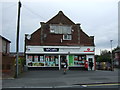
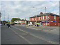
Daily life in PR2 6PG benefits from a selection of retail and transport amenities within easy reach. For your shopping needs, Tesco Ribbleton, Morrisons Daily Preston 217, and Spar offer essential groceries and daily necessities just outside your door. These five notable retail locations ensure you can complete weekly errands without long commutes. Transport connectivity is strengthened by five major railway stations in the immediate vicinity, including Preston Railway Station, Bamber Bridge Railway Station, and Lostock Hall Railway Station. These hubs provide direct links to wider travel networks, making commuting to Manchester or London feasible. The availability of multiple rail options reduces dependency on any single transport link. You can walk or take a short bus ride to access these stations, integrating travel seamlessly into your daily routine. The presence of major supermarkets and rail stations creates a convenient lifestyle that balances urban access with residential quiet. Families will appreciate the ability to shop for fresh food quickly while maintaining easy access to regional travel. The concentration of five retail venues and five railway stations within reach defines the practical convenience of living here. This infrastructure supports active lifestyles and frequent travel without the need for a private vehicle for every trip.
Amenities
Schools
Families in PR2 6PG have access to a cluster of primary schools within practical reach. Preston Grange Primary School holds a good Ofsted rating and offers excellent education for young children. Moor Nook Community Primary School also carries a good Ofsted rating, providing a second high-quality option for parents. The Blessed Sacrament Catholic Primary School rounds out the local choices, serving as a faith-based educational institution for those seeking specific religious instruction. You will find four distinct school names listed in the immediate vicinity, giving residents multiple pathways for their children's education. The presence of two primary schools with good ratings suggests a strong focus on local academic performance. The mix of community and Catholic schools means families have choices based on their religious preferences or desired teaching philosophy. No secondary schools are listed in the provided data, so families will likely need to commute to larger Preston hubs for secondary education. This detail is important for parents considering this area for the first time. The concentration of rated primary schools indicates that early childhood education is well-supported locally. When searching for schools near PR2 6PG, you will find these four institutions as the main options. Their proximity to the postcode ensures short commutes for preschool and primary-aged children.
| Rank | School | Type | Entry gender | Ages |
|---|
Explore more schools in this area
Go to Schools tabDemographics
The community in PR2 6PG is predominantly composed of middle-aged adults, with a median age of 47 years. The most common age range falls between 30 and 64 years, indicating a neighbourhood populated by established families and long-term residents rather than students or retirees. Home ownership stands at 34 per cent, suggesting a significant portion of the population lives in rented accommodation or shared properties. Houses form the primary type of accommodation within this postcode, aligning with the needs of the adult demographic present. The predominant ethnic group is White, reflecting the general demographic trends of the region. This age profile implies a stable community where families have likely settled down to raise children. The lower rate of home ownership compared to national averages could indicate a rental-heavy market or a depression of property prices that affects first-time buyers. You can expect neighbours to include those who have lived in the area for decades alongside those renting for work-related reasons. The concentration of adults suggests less transient movement compared to student-heavy zones, potentially offering a calmer environment for families. The data confirms a mature demographic that values stability and established local infrastructure.
Household Size
Accommodation Type
Tenure
Ethnic Group
Religion
Household Composition
Age
Household Deprivation
NS-SEC
Explore more demographic insights in this area
Go to Demographics tabPlanning
Planning Constraints
- Flood RiskPremium
- Ramsar Wetland SitesPremium
- Area of Outstanding Natural BeautyPremium
- Protected Nature ReservePremium
- Protected WoodlandPremium