Area Overview for PR1 8UN
Photos of PR1 8UN
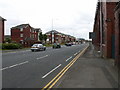
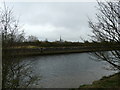

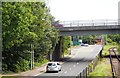
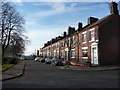
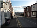
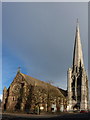

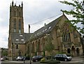

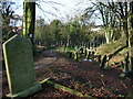
100 photos from this area
Area Information
Key information about the PR1 8UN including its size, population, and administrative classification.
- Area Type
- Postcode
- Area Size
- 1.6 hectares
- Population
- 2675
- Population Density
- 4025 people/km²
House Prices in PR1 8UN
60
Properties
£83,426
Average Sold Price
£34,635
Lowest Price
£155,000
Highest Price
Showing 60 properties
| Address | Type | Beds | Baths | Last Sale Price | Last Sale Date | |
|---|---|---|---|---|---|---|
| 19 Beamont Drive, Preston, PR1 8UN | Terraced | 1 | 1 | £101,000 | Jul 2025 | |
| 5 Beamont Drive, Preston, PR1 8UN | Semi-detached | 2 | 1 | £155,000 | Jun 2025 | |
| 49 Beamont Drive, Preston, PR1 8UN | Flat | 1 | 1 | £85,000 | Jul 2024 | |
| 32 Beamont Drive, Preston, PR1 8UN | Flat | - | - | £68,000 | Mar 2023 | |
| 29 Beamont Drive, Preston, PR1 8UN | Flat | - | - | £78,000 | Oct 2022 | |
| 42 Beamont Drive, Preston, PR1 8UN | Flat | 1 | 1 | £77,500 | Feb 2022 | |
| 54 Beamont Drive, Preston, PR1 8UN | Terraced | 2 | 1 | £117,000 | Aug 2021 | |
| 24 Beamont Drive, Preston, PR1 8UN | Semi-detached | 2 | 1 | £108,500 | Jul 2021 | |
| 38 Beamont Drive, Preston, PR1 8UN | Flat | - | - | £72,000 | Jun 2021 | |
| 36 Beamont Drive, Preston, PR1 8UN | Terraced | 2 | 1 | £103,500 | Mar 2021 |
Page 1 of 6
Energy Efficiency in PR1 8UN
Amenities
Schools
| Rank | School | Type | Entry gender | Ages |
|---|
Explore more schools in this area
Go to Schools tabDemographics
Household Size
One person
most common
Accommodation Type
Houses
most common
Tenure
41
majority
Ethnic Group
White
most common
Religion
N/A
most common
Household Composition
N/A
most common
Age
22
median
Young Adults (15-29 years)
most common
Household Deprivation
N/A
with no deprivation
NS-SEC
11
in Lower managerial occupations
Explore more demographic insights in this area
Go to Demographics tabPlanning
Planning Constraints
- Flood RiskPremium
- Ramsar Wetland SitesPremium
- Area of Outstanding Natural BeautyPremium
- Protected Nature ReservePremium
- Protected WoodlandPremium