Area Overview for PR1 8UA
Photos of PR1 8UA
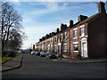
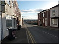
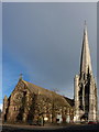
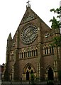
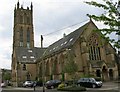
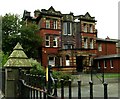
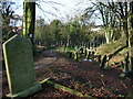
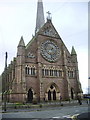
100 photos from this area
Area Information
Key information about the PR1 8UA including its size, population, and administrative classification.
- Area Type
- Postcode
- Area Size
- 3956 m²
- Population
- 2675
- Population Density
- 4025 people/km²
House Prices in PR1 8UA
23
Properties
£102,886
Average Sold Price
£48,000
Lowest Price
£135,000
Highest Price
Showing 23 properties
| Address | Type | Beds | Baths | Last Sale Price | Last Sale Date | |
|---|---|---|---|---|---|---|
| 21 West View Terrace, Preston, PR1 8UA | Terraced | 2 | 1 | £122,500 | Aug 2025 | |
| 7 West View Terrace, Preston, PR1 8UA | Detached | 2 | 1 | £98,000 | Sep 2024 | |
| 17 West View Terrace, Preston, PR1 8UA | Terraced | 3 | 1 | £129,000 | Aug 2024 | |
| 3 West View Terrace, Preston, PR1 8UA | Terraced | 2 | 1 | £93,000 | Apr 2024 | |
| 4 West View Terrace, Preston, PR1 8UA | house | - | - | £120,000 | Dec 2022 | |
| 18 West View Terrace, Preston, PR1 8UA | Terraced | 3 | 1 | £125,000 | Apr 2021 | |
| 22 West View Terrace, Preston, PR1 8UA | house | 4 | - | £97,000 | May 2020 | |
| 2 West View Terrace, Preston, PR1 8UA | Terraced | - | - | £110,000 | Dec 2017 | |
| 5 West View Terrace, Preston, PR1 8UA | Terraced | 2 | 1 | £100,000 | Aug 2016 | |
| 14 West View Terrace, Preston, PR1 8UA | house | - | - | £107,500 | Feb 2013 |
Page 1 of 3
Energy Efficiency in PR1 8UA
Amenities
Schools
| Rank | School | Type | Entry gender | Ages |
|---|
Explore more schools in this area
Go to Schools tabDemographics
Household Size
One person
most common
Accommodation Type
Houses
most common
Tenure
41
majority
Ethnic Group
White
most common
Religion
N/A
most common
Household Composition
N/A
most common
Age
22
median
Young Adults (15-29 years)
most common
Household Deprivation
N/A
with no deprivation
NS-SEC
11
in Lower managerial occupations
Explore more demographic insights in this area
Go to Demographics tabPlanning
Planning Constraints
- Flood RiskPremium
- Ramsar Wetland SitesPremium
- Area of Outstanding Natural BeautyPremium
- Protected Nature ReservePremium
- Protected WoodlandPremium