Area Overview for OL3 5UT
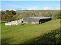
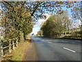
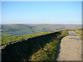
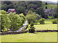
Photos of OL3 5UT


Area Information
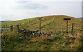
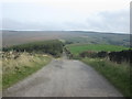
OL3 5UT is a specific postcode covering a compact residential cluster in Greater Manchester. The area encompasses 4.7 hectares and supports a population of 1109 people. This density creates a close-knit environment where residents share limited shared space, resulting in a population density of 1056 people per square kilometre. Living in OL3 5UT involves navigating a distinctively small footprint within the wider Rochdale borough. You are effectively part of a contained community rather than a sprawling suburb. The character of this postcode is defined by its residential focus and constrained geographical limits. Daily life here centres on immediate neighbours and local facilities that sit just outside these tight boundaries. Prospective buyers should view this as a semi-rural yet accessible pocket of the Saddleworth region. The location offers a quiet retreat from larger urban centres while maintaining proximity to key transport hubs. You will find that the pace of life aligns with the modest scale of the land available.
- Area Type
- Postcode
- Area Size
- 4.7 hectares
- Population
- 1109
- Population Density
- 1056 people/km²
The housing market in OL3 5UT is overwhelmingly owner-occupied. You can rely on the fact that 67% of homes in this postcode are owned outright or with a mortgage. Houses constitute the main form of accommodation, confirming that the stock consists of detached or semi-detached family dwellings. This is not a rental-heavy zone, so you are likely to engage directly with homeowners. Given the small area size of 4.7 hectares, the total number of properties on the market will be limited at any one time. Homes in OL3 5UT serve a local demographic that values stability and permanence. The lack of high-density flats means space is a defining feature. You are purchasing a foothold in a community where tenancy is the exception rather than the rule. This structure generally leads to more predictable selling dynamics compared to volatile rental markets.
House Prices in OL3 5UT
Showing 13 properties
| Address | Type | Beds | Baths | Last Sale Price | Last Sale Date | |
|---|---|---|---|---|---|---|
| 117 Delph Lane, Delph, OL3 5UT | house | - | - | £396,500 | Mar 2021 | |
| 125 Delph Lane, Delph, OL3 5UT | Terraced | 2 | 1 | £188,000 | Dec 2015 | |
| 119 Delph Lane, Delph, OL3 5UT | Terraced | - | - | £93,750 | Mar 2002 | |
| 123 Delph Lane, Delph, OL3 5UT | house | - | - | £56,000 | Jul 1997 | |
| Paddock House, Delph Lane, Delph, OL3 5UT | Farm | - | - | - | - | |
| Intake Head, Delph Lane, Delph, OL3 5UT | Detached | - | - | - | - | |
| Sandbed Farm, Delph Lane, Delph, OL3 5UT | Detached | - | - | - | - | |
| 121 Delph Lane, Delph, OL3 5UT | Terraced | - | - | - | - | |
| 1, Intake Head, Delph Lane, Delph, OL3 5UT | house | - | - | - | - | |
| 115 Delph Lane, Delph, OL3 5UT | Terraced | - | - | - | - |
Energy Efficiency in OL3 5UT
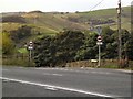
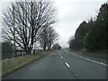
Daily convenience for residents of OL3 5UT depends on travelling just beyond the 4.7-hectare boundary to reach key amenities. No 250 metres will find the Co-op Delph and Co-op Uppermill stores, alongside the larger Tesco Saddleworth supermarket, which serve weekly shopping needs. There are 5 notable retail locations within practical reach. For commuters, the Hull Beck Valley railway corridor provides vital links. Greenfield, Marsden, and Mossley Railway Stations are the designated rail points, with 5 stations listed as being of practical utility. Integrated transport options include the Metrolink services at Shaw and Crompton, Newhey, and Derker, another 5 key stopping points. This network of 5 rail stations and 5 Metrolink stops ensures you can easily access larger employment centres. You will find that supermarkets and train lines are close enough to support a full working week without major delays.
Amenities
Schools
Families looking at homes in OL3 5UT have access to specific educational options nearby. Delph Primary School stands as the nearest primary institution. The school holds a good Ofsted rating, which indicates a standard of education that meets national expectations. This single listed option focuses on younger children age 5 to 11. For secondary education, the data only provides confirmation of this primary school. You must look beyond the immediate postcode for comprehensive schools, as the provided information highlights only Delph Primary School with this rating. This mix suggests that residents often commute to secondary education elsewhere in the Rochdale or Halifax districts. The presence of a well-rated primary school anchors the area for young families who start their children's education locally.
| Rank | School | Type | Entry gender | Ages |
|---|
Explore more schools in this area
Go to Schools tabDemographics
The community of OL3 5UT reflects the broader demographics of the local population. Data shows the median age is 47 years, with adults aged between 30 and 64 years being the most common age range. This indicates a neighbourhood dominated by established residents and families rather than young professionals or retirees. A significant majority of households, standing at 67%, are owner-occupied. This high level of home ownership suggests relative financial stability among residents and a tendency to stay in the area long-term. Houses form the predominant accommodation type, meaning you will encounter single-family dwellings rather than flats or purpose-built apartments. The area is ethically diverse, though white residents represent the predominant ethnic group. Living in this area offers the security of a settled community where tenure is primarily private rather than rental. The age profile suggests schools and family-oriented activities are central to the local social fabric.
Household Size
Accommodation Type
Tenure
Ethnic Group
Religion
Household Composition
Age
Household Deprivation
NS-SEC
Explore more demographic insights in this area
Go to Demographics tabPlanning
Planning Constraints
- Flood RiskPremium
- Ramsar Wetland SitesPremium
- Area of Outstanding Natural BeautyPremium
- Protected Nature ReservePremium
- Protected WoodlandPremium