Area Overview for OL3 5HX
Photos of OL3 5HX
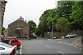


47 photos from this area
Area Information
Key information about the OL3 5HX including its size, population, and administrative classification.
- Area Type
- Postcode
- Area Size
- 6.1 hectares
- Population
- 1109
- Population Density
- 1056 people/km²
House Prices in OL3 5HX
73
Properties
£240,940
Average Sold Price
£71,500
Lowest Price
£662,500
Highest Price
Showing 73 properties
| Address | Type | Beds | Baths | Last Sale Price | Last Sale Date | |
|---|---|---|---|---|---|---|
| 89 Delph Lane, Delph, OL3 5HX | house | - | - | £360,000 | Dec 2024 | |
| 12 Delph Lane, Delph, OL3 5HX | Terraced | 3 | 1 | £230,000 | Jul 2022 | |
| 44 Delph Lane, Delph, OL3 5HX | house | - | - | £280,000 | Jun 2022 | |
| 87 Delph Lane, Delph, OL3 5HX | Bungalow | - | - | £365,000 | Sep 2021 | |
| 16 Delph Lane, Delph, OL3 5HX | Terraced | 2 | 1 | £260,000 | Sep 2021 | |
| 83 Delph Lane, Delph, OL3 5HX | house | - | - | £337,000 | Aug 2021 | |
| 92 Delph Lane, Delph, OL3 5HX | Detached | 4 | 2 | £390,000 | Jan 2021 | |
| 56 Delph Lane, Delph, OL3 5HX | Terraced | 3 | - | £240,000 | May 2020 | |
| 60 Delph Lane, Delph, OL3 5HX | Terraced | 3 | - | £230,000 | Jul 2019 | |
| 62 Delph Lane, Delph, OL3 5HX | house | - | - | £199,000 | Aug 2018 |
Page 1 of 8
Energy Efficiency in OL3 5HX
Amenities
Schools
| Rank | School | Type | Entry gender | Ages |
|---|
Explore more schools in this area
Go to Schools tabDemographics
Household Size
Two person
most common
Accommodation Type
Houses
most common
Tenure
67
majority
Ethnic Group
White
most common
Religion
N/A
most common
Household Composition
N/A
most common
Age
47
median
Adults (30-64 years)
most common
Household Deprivation
N/A
with no deprivation
NS-SEC
39
in Lower managerial occupations
Explore more demographic insights in this area
Go to Demographics tabPlanning
Planning Constraints
- Flood RiskPremium
- Ramsar Wetland SitesPremium
- Area of Outstanding Natural BeautyPremium
- Protected Nature ReservePremium
- Protected WoodlandPremium