Area Overview for OL16 4PR
Photos of OL16 4PR
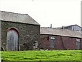
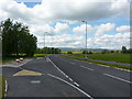
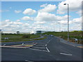

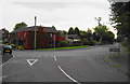
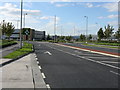
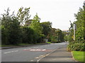
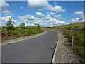

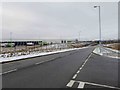
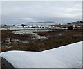

49 photos from this area
Area Information
Key information about the OL16 4PR including its size, population, and administrative classification.
- Area Type
- Postcode
- Area Size
- 1.5 hectares
- Population
- 1810
- Population Density
- 3242 people/km²
House Prices in OL16 4PR
13
Properties
£253,688
Average Sold Price
£107,000
Lowest Price
£375,000
Highest Price
Showing 13 properties
| Address | Type | Beds | Baths | Last Sale Price | Last Sale Date | |
|---|---|---|---|---|---|---|
| 226A Broad Lane, Rochdale, OL16 4PR | house | - | - | £372,500 | Jan 2023 | |
| 224 Broad Lane, Rochdale, OL16 4PR | house | - | - | £375,000 | May 2022 | |
| 226 Broad Lane, Rochdale, OL16 4PR | Detached | 3 | 2 | £300,000 | Nov 2021 | |
| 228 Broad Lane, Rochdale, OL16 4PR | house | - | - | £187,500 | Nov 2019 | |
| 220 Broad Lane, Rochdale, OL16 4PR | house | - | - | £236,000 | May 2017 | |
| 218 Broad Lane, Rochdale, OL16 4PR | Detached | 4 | 2 | £249,500 | Aug 2016 | |
| 230 Broad Lane, Rochdale, OL16 4PR | house | 3 | - | £107,000 | Oct 2013 | |
| 234 Broad Lane, Rochdale, OL16 4PR | Detached | - | - | £202,000 | May 2006 | |
| 236 Broad Lane, Rochdale, OL16 4PR | Detached | - | - | - | - | |
| 232 Broad Lane, Rochdale, OL16 4PR | house | - | - | - | - |
Page 1 of 2
Energy Efficiency in OL16 4PR
Amenities
Schools
| Rank | School | Type | Entry gender | Ages |
|---|
Explore more schools in this area
Go to Schools tabDemographics
Household Size
One person
most common
Accommodation Type
Houses
most common
Tenure
59
majority
Ethnic Group
White
most common
Religion
N/A
most common
Household Composition
N/A
most common
Age
47
median
Adults (30-64 years)
most common
Household Deprivation
N/A
with no deprivation
NS-SEC
29
in Lower managerial occupations
Explore more demographic insights in this area
Go to Demographics tabPlanning
Planning Constraints
- Flood RiskPremium
- Ramsar Wetland SitesPremium
- Area of Outstanding Natural BeautyPremium
- Protected Nature ReservePremium
- Protected WoodlandPremium