Area Overview for OL16 3HA
Photos of OL16 3HA
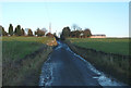
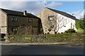
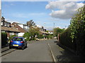
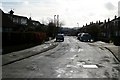
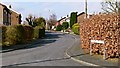
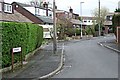
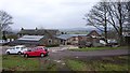
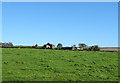
44 photos from this area
Area Information
Key information about the OL16 3HA including its size, population, and administrative classification.
- Area Type
- Postcode
- Area Size
- 1.0 hectares
- Population
- 1383
- Population Density
- 395 people/km²
House Prices in OL16 3HA
26
Properties
£170,261
Average Sold Price
£60,000
Lowest Price
£290,000
Highest Price
Showing 26 properties
| Address | Type | Beds | Baths | Last Sale Price | Last Sale Date | |
|---|---|---|---|---|---|---|
| 112 Kiln Lane, Milnrow, OL16 3HA | Bungalow | 3 | 2 | £205,000 | Oct 2023 | |
| 144 Kiln Lane, Milnrow, OL16 3HA | Bungalow | - | - | £290,000 | Nov 2022 | |
| 122 Kiln Lane, Milnrow, OL16 3HA | house | - | - | £225,000 | Dec 2021 | |
| 124 Kiln Lane, Milnrow, OL16 3HA | house | - | - | £200,000 | Mar 2021 | |
| 140 Kiln Lane, Milnrow, OL16 3HA | house | - | - | £200,000 | Oct 2020 | |
| 108 Kiln Lane, Milnrow, OL16 3HA | house | - | - | £195,000 | Mar 2020 | |
| 98 Kiln Lane, Milnrow, OL16 3HA | Semi-detached | 3 | - | £225,000 | Oct 2019 | |
| 132 Kiln Lane, Milnrow, OL16 3HA | Semi-detached | 3 | 2 | £220,000 | Aug 2019 | |
| 138 Kiln Lane, Milnrow, OL16 3HA | Semi-detached | 3 | 1 | £155,000 | Jul 2017 | |
| 128 Kiln Lane, Milnrow, OL16 3HA | Semi-detached | 3 | 1 | £202,000 | Jan 2017 |
Page 1 of 3
Energy Efficiency in OL16 3HA
Amenities
Schools
| Rank | School | Type | Entry gender | Ages |
|---|
Explore more schools in this area
Go to Schools tabDemographics
Household Size
Family (3-5 people)
most common
Accommodation Type
Houses
most common
Tenure
83
majority
Ethnic Group
White
most common
Religion
N/A
most common
Household Composition
N/A
most common
Age
47
median
Adults (30-64 years)
most common
Household Deprivation
N/A
with no deprivation
NS-SEC
42
in Lower managerial occupations
Explore more demographic insights in this area
Go to Demographics tabPlanning
Planning Constraints
- Flood RiskPremium
- Ramsar Wetland SitesPremium
- Area of Outstanding Natural BeautyPremium
- Protected Nature ReservePremium
- Protected WoodlandPremium