Area Overview for OL16 3EW
Photos of OL16 3EW
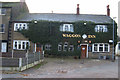
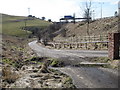
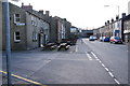
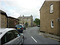
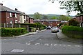

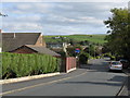
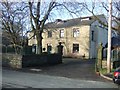
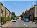
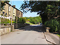
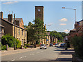
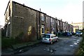
97 photos from this area
Area Information
Key information about the OL16 3EW including its size, population, and administrative classification.
- Area Type
- Postcode
- Area Size
- 1.4 hectares
- Population
- 1594
- Population Density
- 5022 people/km²
House Prices in OL16 3EW
38
Properties
£145,276
Average Sold Price
£650
Lowest Price
£274,000
Highest Price
Showing 38 properties
| Address | Type | Beds | Baths | Last Sale Price | Last Sale Date | |
|---|---|---|---|---|---|---|
| 9 Crossgates Road, Milnrow, OL16 3EW | Bungalow | - | - | £750 | Jul 2025 | |
| 34 Crossgates Road, Milnrow, OL16 3EW | Semi-detached | 3 | 2 | £274,000 | Mar 2025 | |
| 20 Crossgates Road, Milnrow, OL16 3EW | house | - | - | £222,000 | Jun 2024 | |
| 5 Crossgates Road, Milnrow, OL16 3EW | Semi-detached | 3 | 2 | £230,000 | Oct 2022 | |
| 18 Crossgates Road, Milnrow, OL16 3EW | Bungalow | 4 | 2 | £229,999 | Jun 2022 | |
| 23 Crossgates Road, Milnrow, OL16 3EW | Semi-detached | - | - | £90,000 | Feb 2022 | |
| 32 Crossgates Road, Milnrow, OL16 3EW | Terraced | - | - | £650 | Jun 2021 | |
| 7 Crossgates Road, Milnrow, OL16 3EW | Semi-detached | 3 | 2 | £184,000 | Dec 2020 | |
| 22 Crossgates Road, Milnrow, OL16 3EW | Semi-detached | 2 | 1 | £135,000 | Oct 2019 | |
| 15 Crossgates Road, Milnrow, OL16 3EW | Semi-detached | 3 | 1 | £180,000 | Feb 2019 |
Page 1 of 4
Energy Efficiency in OL16 3EW
Amenities
Schools
| Rank | School | Type | Entry gender | Ages |
|---|
Explore more schools in this area
Go to Schools tabDemographics
Household Size
Family (3-5 people)
most common
Accommodation Type
Houses
most common
Tenure
60
majority
Ethnic Group
White
most common
Religion
N/A
most common
Household Composition
N/A
most common
Age
47
median
Adults (30-64 years)
most common
Household Deprivation
N/A
with no deprivation
NS-SEC
31
in Lower managerial occupations
Explore more demographic insights in this area
Go to Demographics tabPlanning
Planning Constraints
- Flood RiskPremium
- Ramsar Wetland SitesPremium
- Area of Outstanding Natural BeautyPremium
- Protected Nature ReservePremium
- Protected WoodlandPremium