Area Overview for OL15 8RF
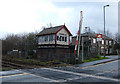
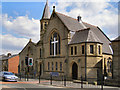
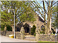
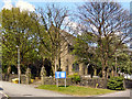
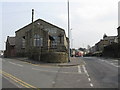
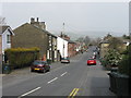
Photos of OL15 8RF


Area Information
Living in OL15 8RF offers a specific residential experience within a tight-knit local cluster defined by this single postcode. The area covers exactly 6607 square metres and houses a population of 1831 people. This small footprint results in a very high population density of 277,122 people per square kilometre, indicating a tightly packed neighbourhood environment. Residents here experience daily life in close proximity to one another, with every household situated within a very limited geographical boundary. The character of the area is shaped by its compact nature, where the distance between individual homes across the postcode estate is measured in metres rather than a wider suburban sprawl. For prospective buyers, understanding the scale of OL15 8RF is essential before viewing available homes. The concentration of people within this small space creates a distinct community dynamic that differs from larger towns or more spread-out villages. You will find yourself in a location where the immediate surroundings encompass almost the entire population record for this specific block. This density ensures that local services and amenities are accessed quickly, though the sheer concentration of residents within such a small area defines the local atmosphere. Your perspective of the environment here is immediate and direct, reflecting the precise statistics of the 6607 square metre zone.
- Area Type
- Postcode
- Area Size
- 6607 m²
- Population
- 1831
- Population Density
- 3217 people/km²
The property market in OL15 8RF centres on a stock primarily composed of houses, reflecting the accommodation type data for this postcode. With 71 per cent of the population owning their homes, this area functions as an owner-occupied zone rather than a high-volume buy-to-let or private rental market. The housing landscape is dominated by houses, which suggests plenty of space and traditional architecture, albeit within a compact geographical area covering only 6607 square metres. For buyers looking at homes in OL15 8RF, the high ownership rate means you will encounter many mortgage-holding households and families with long-term tenures. The inclusion of this specific postcode into the OL15 region aligns it with similar residential clusters in Littleborough. This market structure implies stability, with fewer transient occupants moving frequently through the area. If you are pricing a sale or looking to purchase in this labour market context, the high lock-in rate of 71 per cent ownership reduces the volume of immediate sales compared to a pure rental district. The housing stock is therefore geared towards permanent residents rather than short-term tenants, shaping the transaction dynamics for any property in this small neighbourhood.
House Prices in OL15 8RF
Showing 21 properties
Energy Efficiency in OL15 8RF
Daily life in OL15 8RF is supported by a practical range of nearby amenities situated within easy reach. Residents can access five railway stations, including Smithy Bridge Railway Station, Littleborough Railway Station, and Rochdale Railway Station, providing good rail links for commuting beyond the immediate area. Retail options are equally accessible, with five locations nearby offering essential shops and supermarkets. Notable retailers include Spar, Lidl Stockton Street, and Co-op Littleborough, ensuring you can pick up groceries and daily essentials without leaving the neighbourhood. The area also lists five Metro locations, identified as Kingsway Business Park, Newbold, and Milnrow, which serve as key destinations for work or services. This blend of transport and retail creates a convenient lifestyle where daily errands and commute planning are straightforward. You will find that the cluster of retail units provides a mix of budget supermarkets and local convenience stores tailored for everyday needs. The proximity of these specific venues guarantees that basic requirements for food, transport, and business access are all covered within a short radius of the postcode.
Amenities
Schools
Families living in OL15 8RF have access to a specific selection of local educational facilities, though options are limited in immediate proximity. The nearest listed school is St Mary's Roman Catholic Primary School, Littleborough. This institution serves as a primary education hub for young residents in the area and holds an Ofsted rating of good. The data does not list secondary schools or academies immediately within the dedicated nearby schools section for this specific postcode, suggesting that older children likely commute to institutions in neighbouring towns or larger parts of Littleborough. For families with younger children, the presence of a good-rated primary school provides a solid local foundation for early education. You must consider travel time and catchment areas if you have teenagers, as the immediate list of schools only covers primary provision. The existence of St Mary's Roman Catholic Primary School indicates a traditional Catholic educational route close to the home. Prospective parents should investigate catchment boundaries separately, as the provided data only confirms this one named facility and its current rating.
| Rank | School | Type | Entry gender | Ages |
|---|
Explore more schools in this area
Go to Schools tabDemographics
The community in OL15 8RF is defined by a mature demographic profile and established housing tenure. Data shows that the median age of residents is 47 years, and the most common age range consists of adults between 30 and 64 years old. This indicates a neighbourhood populated largely by working-age families and retired individuals rather than young starters or the very young. Home ownership is a strong feature of this area, with 71 per cent of occupants owning their properties outright or with a mortgage. The remaining population likely comprises a smaller rental sector or non-standard tenure arrangements. Houses form the predominant accommodation type, meaning terraced villas or detached family homes dominate the streetscape rather than purpose-built flats or blocks of multi-storey housing. The predominant ethnic group in the area is White, reflecting a historically established community pattern. For anyone considering homes in OL15 8RF, you are looking at an area where established ownership is the norm and the resident base is firmly rooted in the 30-to-64 age bracket. These figures depict a stable, long-term community structure without significant recent demographic volatility.
Household Size
Accommodation Type
Tenure
Ethnic Group
Religion
Household Composition
Age
Household Deprivation
NS-SEC
Explore more demographic insights in this area
Go to Demographics tabPlanning
Planning Constraints
- Flood RiskPremium
- Ramsar Wetland SitesPremium
- Area of Outstanding Natural BeautyPremium
- Protected Nature ReservePremium
- Protected WoodlandPremium