Area Overview for OL11 3DF
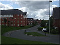
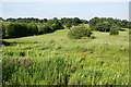
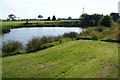
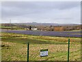
Photos of OL11 3DF


Area Information
Living in OL11 3DF offers a compact residential experience within a small cluster of homes. This specific postcode covers an area size of 5608 square metres, containing a population of 1796 people. The density stands at 1429 people per square kilometre, creating a neighbourhood where space is limited but community presence is high. You are entering an environment defined by its distinct boundaries and concentrated housing stock rather than sprawling suburban development. The area represents a specific snapshot of Greater Manchester living, characterised by high occupancy rates within a very confined footprint. The demographic profile suggests a mature community frequenting the street. With a median age of 47, the local population skews significantly towards adults between 30 and 64 years old. This age dominance shapes the rhythm of daily life, focusing on established households rather than transient student housing. The area does not offer the wide-open spaces of larger settlements but provides immediate proximity to essential services found within practical reach. For someone seeking a defined residential zone with clear limits and a settled population, this postcode delivers a focused living environment. The small total area size means that any changes to the streetscape or local amenities affect nearly every resident.
- Area Type
- Postcode
- Area Size
- 5608 m²
- Population
- 1796
- Population Density
- 1429 people/km²
The property market within OL11 3DF is characterised by strong home ownership levels. Current figures show that 67 percent of households own their homes. This high proportion of owner-occupiers defines the character of the housing stock, which is primarily composed of houses. You are looking at a market where residents have established long-term connections to their addresses rather than short-term rentals. The dominance of houses suggests a preference for detached or semi-detached properties over flats or high-density living arrangements common in inner-city districts. buyers exploring this postcode will find a stock tailored to families and established individuals. The total area size of 5608 square metres limits the volume of properties available, meaning each home holds significant value within the immediate cluster. The high household ownership rate often correlates with lower turnover, reducing vacancy rates and creating a quieter street environment. When considering homes in OL11 3DF, expect to engage with owners who plan for the long term. This market segment contrasts sharply with areas where private landlords dominate the rental sector. The accommodation type profile clearly points towards brick-built or traditional housing rather than modern apartment complexes.
House Prices in OL11 3DF
Showing 39 properties
| Address | Type | Beds | Baths | Last Sale Price | Last Sale Date | |
|---|---|---|---|---|---|---|
| 51 Rodney Street, Rochdale, OL11 3DF | Terraced | 2 | 1 | £75,000 | Jul 2022 | |
| 36 Rodney Street, Rochdale, OL11 3DF | house | - | - | £110,000 | May 2022 | |
| 43 Rodney Street, Rochdale, OL11 3DF | house | - | - | £137,000 | Oct 2021 | |
| 26 Rodney Street, Rochdale, OL11 3DF | Terraced | 2 | 1 | £90,000 | Jun 2021 | |
| 39 Rodney Street, Rochdale, OL11 3DF | house | 2 | - | £75,000 | Oct 2020 | |
| 23 Rodney Street, Rochdale, OL11 3DF | Terraced | 2 | - | £82,500 | Sep 2020 | |
| 42 Rodney Street, Rochdale, OL11 3DF | house | - | - | £85,000 | Feb 2020 | |
| 5 Rodney Street, Rochdale, OL11 3DF | house | - | - | £65,000 | Dec 2018 | |
| 29 Rodney Street, Rochdale, OL11 3DF | Terraced | 2 | 1 | £92,000 | Apr 2018 | |
| 1 Rodney Street, Rochdale, OL11 3DF | Terraced | 2 | 1 | £74,500 | Sep 2017 |
Energy Efficiency in OL11 3DF
Residents of OL11 3DF enjoy convenient access to major transport hubs and retail outlets. Rail connections are within practical reach, with Castleton Railway Station, Rochdale Railway Station, and Mills Hill Railway Station serving the local population. These five nearby stations provide the rail links necessary for commuting to Manchester and beyond. Ten retail locations are situated nearby, anchored by key supermarkets such as Co-op Grosvenor, Tesco Rochdale, and Aldi Heywood. These grocery stores ensure that daily shopping needs are met without long journeys. Metro connectivity is also robust, with Heywood, Rochdale Town Centre, and Rochdale Interchange acting as major transport nodes. You can access five distinct metro-related points close to the postcode, facilitating easy movement across Greater Manchester. Shopping trips do not require cars if you utilise Tesco Rochdale or Aldi Heywood. The presence of these specific retail giants indicates a well-supplied commercial corridor nearby. For lunch or evening purchases, Co-op Grosvenor adds further choice to the local high street options. This blend of rail gates and major supermarkets creates a self-sufficient lifestyle where daily errands are manageable by public transit or short drives.
Amenities
Schools
Families considering schooling options near OL11 3DF have two specific institutions available within close proximity. St Edward's Church of England Primary School operates as a primary education provider. Its latest Ofsted rating is satisfactory, indicating it meets expected standards for primary level education. The second key institution is Pleasant Street, which functions as a special school. This mixture supports different needs within the community, offering standard primary curriculum alongside specialised education. The presence of a special school nearby may reflect the diversity of learning needs in the wider locality. St Edward's serves the conventional primary school demographic, while Pleasant Street addresses specific educational requirements that differ from the standard national curriculum. Neither school provides secondary education, meaning older children would likely attend institutions further away. For buyers prioritising primary education access, St Edward's offers a route with a confirmed satisfactory rating. The dual presence of a main primary and a special school ensures that residents have immediate access to significant educational support. Navigating the school catchment would require checking official boundaries, but both schools are accessible assets for local families.
| Rank | School | Type | Entry gender | Ages |
|---|
Explore more schools in this area
Go to Schools tabDemographics
The community in OL11 3DF is squarely in the middle years of adulthood, with a median age of 47. The most common age range for residents falls between 30 and 64 years. This concentration of working-age adults suggests a stable resident base likely involved in careers or raising families rather than attracting young students or retirees. Home ownership remains a central feature of daily life in this postcode, with 67 percent of households owning their property outright or with a mortgage. This high rate indicates a settled population that has put down roots in the OL11 3DF location. Accommodation types are predominantly houses, which aligns with the profile of older families. Predominant ethnic classification shows a White majority, reflecting a traditional demographic pattern common in parts of Greater Manchester. The population density of 1429 people per square kilometre confirms a tight-knit neighbourhood structure where neighbours often know one another. Approximately two-thirds of residents are homeowners, implying lower churn rates compared to areas dominated by rental markets. The absence of significant youth or elderly outliers in the data points to a balanced, middle-aged population managing their domestic lives within these specific geographic bounds.
Household Size
Accommodation Type
Tenure
Ethnic Group
Religion
Household Composition
Age
Household Deprivation
NS-SEC
Explore more demographic insights in this area
Go to Demographics tabPlanning
Planning Constraints
- Flood RiskPremium
- Ramsar Wetland SitesPremium
- Area of Outstanding Natural BeautyPremium
- Protected Nature ReservePremium
- Protected WoodlandPremium