Area Overview for OL10 2HW
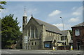
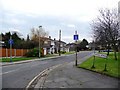
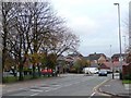
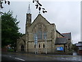
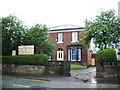
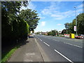
Photos of OL10 2HW


Area Information
OL10 2HW is a small residential cluster situated within the Hopwood Hall Ward of the Metropolitan Borough of Rochdale in Greater Manchester. This postcode covers an exact area of 1986 square metres and forms part of a broader landscape named after a historic Grade II* listed manor house. Middleton lies approximately one mile to the south, while Manchester city centre sits six miles away to the southwest. The location sits within a district that includes parts of the original Hopwood Hall estate grounds, an area now partially occupied by Hopwood Hall College. Residents live in close proximity to this significant heritage site, which dates back to the 14th century and was famously associated with Lord Byron. The immediate environment reflects the history of the Hopwood family, who owned the land for over 500 years. Daily life here involves navigating a community defined by its deep historical roots and its position on the periphery of established town centres. The ward offers a slice of northern English history where modern residential living intersects with the legacy of a manor house recognised by Historic England. You are looking at a compact living space that connects you to both the medieval past and contemporary schoollands.
- Area Type
- Postcode
- Area Size
- 1986 m²
- Population
- 2261
- Population Density
- 2440 people/km²
The property market in OL10 2HW is dominated by traditional housing stock rather than interconnected flats or converted apartments. Data confirms that houses constitute the predominant accommodation type within this postcode sector. This structure supports a market heavily weighted towards owner occupation, where 64% of households hold properties. The remaining households likely include private renters or social housing tenants within the same house-dominated landscape. You are looking at an area where single-family homes define the skyline and street patterns. The high rate of home ownership suggests that residents view these properties as long-term investments and family homes. This contrasts sharply with larger urban centres where rental cultures drive the market. The limited square footage of 1986 square metres indicates that individual properties are sized for family living rather than starter apartments or student digs. Buyers seeking detached or semi-detached properties will find this an appropriate location. The market here is not driven by high-density regeneration or new-build developments. Existing stock continues to meet the needs of the local demographic. You will encounter a property market governed by the availability of traditional houses rather than the conversion of commercial units.
House Prices in OL10 2HW
Showing 8 properties
| Address | Type | Beds | Baths | Last Sale Price | Last Sale Date | |
|---|---|---|---|---|---|---|
| 11 Barlow Street, Heywood, OL10 2HW | Terraced | 2 | 1 | £118,000 | Jul 2024 | |
| 4 Barlow Street, Heywood, OL10 2HW | house | - | - | £75,000 | Apr 2021 | |
| 6 Barlow Street, Heywood, OL10 2HW | house | - | - | £72,000 | Apr 2005 | |
| 9 Barlow Street, Heywood, OL10 2HW | Terraced | 2 | 1 | £34,000 | Apr 2002 | |
| 7 Barlow Street, Heywood, OL10 2HW | house | - | - | - | - | |
| 8 Barlow Street, Heywood, OL10 2HW | Terraced | - | - | - | - | |
| 5 Barlow Street, Heywood, OL10 2HW | house | - | - | - | - | |
| 3 Barlow Street, Heywood, OL10 2HW | Terraced | 2 | 1 | - | - |
Energy Efficiency in OL10 2HW
Residents of OL10 2HW enjoy access to a wide array of amenities located within practical reach without requiring car travel for every trip. Retail options are accessible within the neighbourhood, with five notable stores available. Asda Heywood, Aldi Heywood, and Tesco Heywood York serve the daily grocery and shopping needs of the population. Beyond food shopping, transport links provide access to five metro hubs, including the Rochdale Town Centre and the Rochdale Interchange. Five railway stations are also within reach, including Castleton Railway Station, Mills Hill Railway Station, and Rochdale Railway Station. This connectivity allows you to travel six miles to Manchester city centre or connect to wider regional networks effortlessly. The area does not list specific parks, leisure centres, or dining venues within the immediate data, but the transport infrastructure ensures you can reach these from the town centres. You will find a lifestyle defined by convenience shopping and regional travel opportunities rather than isolated village pubs or local cinemas. The proximity to major retail chains and transport nodes makes daily errands efficient and manageable.
Amenities
Schools
Families with children in OL10 2HW have access to a specific list of educational institutions nearby. The most prominent school serving this vicinity is Hopwood Community Primary School. This establishment operates as a primary school and holds an outstanding Ofsted rating. An outstanding rating is the highest score available and signifies very high standards of teaching and care. No secondary schools are listed in the immediate data for this specific postcode, placing the primary focus of the immediate catchment on early education. The presence of a single named primary school with top-tier ratings suggests a strong local investment in foundational education. Parents viewing homes near this postcode can expect proximity to a school with a proven track record of success. The mix of educational provision is currently narrow, focusing entirely on the primary phase within the verified dataset. You must consider transport links and zoning boundaries to confirm which specific catchment areas apply to individual street addresses within OL10 2HW. The region relies heavily on this one outstanding-rated institution for its young pupils.
| Rank | School | Type | Entry gender | Ages |
|---|
Explore more schools in this area
Go to Schools tabDemographics
The community in OL10 2HW has a distinctly mature character derived from solid demographic data. The resident population numbers 2261 people living within the specific postcode area. The median age for inhabitants is 47 years, indicating a neighbourhood where adults between the ages of 30 and 64 form the most common age range. This age structure suggests a village-like community rather than a young, transient student population. Home ownership stands at a high level, with 64% of households owning their residences outright or with a mortgage. This implies a stable community where long-term residents have established deep roots in the ward. The predominant ethnic group is White, reflecting the traditional demographic makeup of the northwestern counties. Accommodation types are primarily houses, aligning with the suburban perception of Middleton and the surrounding estates. There is no significant young professional influx or student housing dominance in this specific cluster. The population density figures reflect a clustered residential pattern typical of established English housebuilding from previous decades. You will find a neighbourhood defined by permanence and ownership rather than temporary tenancy.
Household Size
Accommodation Type
Tenure
Ethnic Group
Religion
Household Composition
Age
Household Deprivation
NS-SEC
Explore more demographic insights in this area
Go to Demographics tabPlanning
Planning Constraints
- Flood RiskPremium
- Ramsar Wetland SitesPremium
- Area of Outstanding Natural BeautyPremium
- Protected Nature ReservePremium
- Protected WoodlandPremium