Area Overview for M8 4PY
Photos of M8 4PY
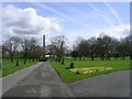
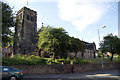
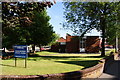
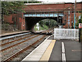

87 photos from this area
Area Information
Key information about the M8 4PY including its size, population, and administrative classification.
- Area Type
- Postcode
- Area Size
- 3601 m²
- Population
- 1786
- Population Density
- 7426 people/km²
House Prices in M8 4PY
19
Properties
£70,723
Average Sold Price
£28,500
Lowest Price
£165,000
Highest Price
Showing 19 properties
| Address | Type | Beds | Baths | Last Sale Price | Last Sale Date | |
|---|---|---|---|---|---|---|
| 3 Givendale Drive, Manchester, M8 4PY | Semi-detached | 2 | 1 | £165,000 | Jun 2024 | |
| 19 Givendale Drive, Manchester, M8 4PY | Flat | - | - | £56,000 | Apr 2024 | |
| 9 Givendale Drive, Manchester, M8 4PY | Semi-detached | 2 | 1 | £127,500 | Mar 2024 | |
| 7 Givendale Drive, Manchester, M8 4PY | Semi-detached | 2 | 1 | £161,000 | Mar 2024 | |
| 25 Givendale Drive, Manchester, M8 4PY | Flat | - | - | £50,000 | Nov 2023 | |
| 27 Givendale Drive, Manchester, M8 4PY | Flat | - | - | £56,000 | Mar 2023 | |
| 15 Givendale Drive, Manchester, M8 4PY | Flat | - | - | £34,000 | May 2014 | |
| 17 Givendale Drive, Manchester, M8 4PY | Flat | - | - | £55,000 | Sep 2008 | |
| 11 Givendale Drive, Manchester, M8 4PY | Bungalow | - | - | £56,666 | Jul 2007 | |
| 6 Givendale Drive, Manchester, M8 4PY | Semi-detached | - | - | £79,000 | Apr 2007 |
Page 1 of 2
Energy Efficiency in M8 4PY
Amenities
Schools
| Rank | School | Type | Entry gender | Ages |
|---|
Explore more schools in this area
Go to Schools tabDemographics
Household Size
One person
most common
Accommodation Type
Houses
most common
Tenure
61
majority
Ethnic Group
asian_total
most common
Religion
N/A
most common
Household Composition
N/A
most common
Age
47
median
Adults (30-64 years)
most common
Household Deprivation
N/A
with no deprivation
NS-SEC
22
in Lower managerial occupations
Explore more demographic insights in this area
Go to Demographics tabPlanning
Planning Constraints
- Flood RiskPremium
- Ramsar Wetland SitesPremium
- Area of Outstanding Natural BeautyPremium
- Protected Nature ReservePremium
- Protected WoodlandPremium