Area Overview for M60 7LH
Photos of M60 7LH


Area Information
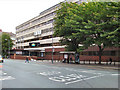
Living in M60 7LH means being part of a densely populated, compact residential cluster in England’s north-west. The area covers just 1056 square metres, yet it is home to 1791 people, creating a high population density of 1.69 million per square kilometre. This small postcode area is defined by its proximity to Manchester’s urban core, with easy access to retail, transport, and cultural hubs. Daily life here is shaped by its youthful demographic—over a quarter of residents are under 30—reflecting a community centred around work, education, and socialising. The area’s flat-dominated housing stock and high rental occupancy suggest a transient population, with many residents likely students or young professionals. While the compact size offers convenience, it also means limited green space and a focus on urban living. For buyers, M60 7LH presents a mix of practicality and challenge: proximity to amenities is offset by concerns about safety and digital connectivity. It is a place where convenience and density define the experience, but where careful consideration of risks is essential.
- Area Type
- Postcode
- Area Size
- 1056 m²
- Population
- 1791
- Population Density
- 6442 people/km²
The property market in M60 7LH is characterised by low home ownership and a focus on rental units. With just 25% of properties owned by residents, the area functions more as a rental market than an owner-occupied one. The dominance of flats suggests a housing stock tailored to students, young professionals, or those seeking short-term accommodation. Given the area’s small size, the available properties are limited, and buyers should consider the broader Manchester region for more options. The compact nature of M60 7LH means that properties are likely to be smaller, with limited scope for expansion or renovation. For investors, the high rental demand among young tenants could present opportunities, but the lack of long-term residents may affect property value stability. Buyers should also note the area’s proximity to transport and amenities, which could offset its drawbacks for those prioritising convenience over permanence.
House Prices in M60 7LH
Showing 100 properties (first 250)
| Address | Type | Beds | Baths | Last Sale Price | Last Sale Date | |
|---|---|---|---|---|---|---|
| Lambert Hall, Granby Row, Manchester, M60 7LH | Flat | 1 | 1 | - | - | |
| Flat F1, Fairfield Hall, Granby Row, Manchester, M60 7LH | Unknown | - | - | - | - | |
| Flat G5, Fairfield Hall, Granby Row, Manchester, M60 7LH | Unknown | - | - | - | - | |
| Flat E6, Fairfield Hall, Granby Row, Manchester, M60 7LH | Unknown | - | - | - | - | |
| Flat B8, Lambert Hall, Granby Row, Manchester, M60 7LH | Unknown | - | - | - | - | |
| Flat G6, Fairfield Hall, Granby Row, Manchester, M60 7LH | Unknown | - | - | - | - | |
| Flat B7, Lambert Hall, Granby Row, Manchester, M60 7LH | Unknown | - | - | - | - | |
| Flat A7, Lambert Hall, Granby Row, Manchester, M60 7LH | Unknown | - | - | - | - | |
| Flat B4, Lambert Hall, Granby Row, Manchester, M60 7LH | Unknown | - | - | - | - | |
| Flat D5, Fairfield Hall, Granby Row, Manchester, M60 7LH | Unknown | - | - | - | - |
Energy Efficiency in M60 7LH
Residents of M60 7LH have access to a range of urban amenities within walking or short transit distance. Retail options include Sainsburys Manchester, M&S Piccadilly SF, and Co-op Gateway, providing everyday shopping needs. The area’s proximity to Piccadilly Gardens and St Peter’s Square adds a touch of urban greenery and public space. Metro and rail stations offer seamless access to Manchester’s cultural and commercial districts, while the Chorlton Street Coach Station connects to broader regional routes. For leisure, the area’s compact size means residents are close to the city’s nightlife, dining, and entertainment venues. However, the absence of significant parks or recreational spaces highlights a reliance on nearby urban amenities. The lifestyle here is convenience-driven, with a focus on accessibility over natural environments. Those prioritising proximity to retail and transport will find M60 7LH highly functional, though it may lack the tranquillity of suburban settings.
Amenities
Schools
| Rank | School | Type | Entry gender | Ages |
|---|
Explore more schools in this area
Go to Schools tabDemographics
M60 7LH has a median age of 22, with the majority of residents falling within the 15–29 age range. This reflects a community dominated by young adults, likely students or early-career professionals. Home ownership is low, with only 25% of properties owned by residents, indicating a rental-heavy market. The area’s accommodation is almost entirely flats, a format that suits transient populations but may limit long-term investment potential. The predominant ethnic group is White, though specific diversity metrics are not provided. The high proportion of young people suggests a dynamic, social environment, but also potential challenges in community stability. With 1791 residents packed into a small area, density influences everything from local services to social interactions. For buyers, understanding the area’s demographic profile is key: it is not a place for long-term family living but rather a hub for those seeking short-term housing in a city-centre location.
Household Size
Accommodation Type
Tenure
Ethnic Group
Religion
Household Composition
Age
Household Deprivation
NS-SEC
Explore more demographic insights in this area
Go to Demographics tabPlanning
Planning Constraints
- Flood RiskPremium
- Ramsar Wetland SitesPremium
- Area of Outstanding Natural BeautyPremium
- Protected Nature ReservePremium
- Protected WoodlandPremium