Area Overview for M5 5JQ
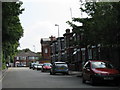
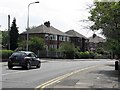
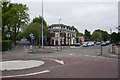
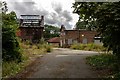
Photos of M5 5JQ


Area Information
Living in M5 5JQ means inhabiting a compact, densely populated residential cluster in England. The area covers just 1.2 hectares, yet it is home to 2032 people, equating to a population density of 167,111 per square kilometre. This small postcode area is characterised by a mix of housing types, though the data specifies that houses are the predominant accommodation. The community is largely composed of adults aged 30–64, with a median age of 47. Daily life here is shaped by proximity to essential services, including multiple schools, retail outlets, and transport hubs. While the area is small, its strategic location offers access to nearby amenities such as railway stations, metro stops, and the City Airport Manchester. The high population density suggests a tightly knit community, though the limited space may influence the character of local interactions and available public spaces.
- Area Type
- Postcode
- Area Size
- 1.2 hectares
- Population
- 2032
- Population Density
- 5486 people/km²
The property market in M5 5JQ is defined by a 41% home ownership rate, indicating that the majority of properties are rented rather than owner-occupied. The area is characterised by houses as the primary accommodation type, which may appeal to families seeking more space than flats. However, the small area size—just 1.2 hectares—suggests limited housing stock and minimal scope for new developments. This compactness could mean that the local property market is highly competitive, with limited options for buyers. For those considering purchase, the low home ownership rate implies a potential rental market, though the small area may restrict the variety of properties available. Buyers should also consider the proximity to transport and amenities, which may influence property values and desirability.
House Prices in M5 5JQ
Showing 6 properties
| Address | Type | Beds | Baths | Last Sale Price | Last Sale Date | |
|---|---|---|---|---|---|---|
| 131 Weaste Lane, Salford, M5 5JQ | Semi-detached | 3 | 1 | £149,000 | Oct 2015 | |
| 133 Weaste Lane, Salford, M5 5JQ | Detached | 3 | 1 | £175,000 | May 2015 | |
| 139 Weaste Lane, Salford, M5 5JQ | Detached | 3 | 1 | £162,000 | Feb 2015 | |
| 129 Weaste Lane, Salford, M5 5JQ | Semi-detached | 5 | - | £134,000 | Sep 2005 | |
| 137 Weaste Lane, Salford, M5 5JQ | Semi-detached | - | - | £48,500 | Mar 1995 | |
| 135 Weaste Lane, Salford, M5 5JQ | house | - | - | - | - |
Energy Efficiency in M5 5JQ
The lifestyle in M5 5JQ is shaped by its proximity to a range of amenities. Residents have access to five retail outlets, including M&S WHS, Lidl Pendleton, and Tesco Salford, ensuring everyday shopping needs are met. The area’s metro and rail stations connect to major destinations, while the nearby City Airport Manchester offers international travel options. The presence of multiple transport hubs, such as Eccles Railway Station and Manchester United FC Railway Station, suggests a dynamic, accessible environment. While the data does not specify parks or leisure facilities, the high population density and compact size imply that public spaces may be limited. Nonetheless, the availability of retail, transport, and dining options contributes to a convenient, urban lifestyle.
Amenities
Schools
Residents of M5 5JQ have access to a range of educational institutions, including primary and sixth-form schools. Tootal Drive Primary School and St Luke’s CofE Primary School cater to younger children, with the latter holding an Ofsted rating of satisfactory. Our Lady of Mount Carmel RC High School, also listed as a primary school, and De La Salle College, a sixth-form institution, provide continuity for families. The mix of school types ensures that parents can plan for their children’s education from early years through to post-16 studies. However, the absence of secondary schools in the data may require families to consider commuting for secondary education. The presence of both faith-based and non-faith schools offers choice, though the Ofsted rating for one primary school suggests room for improvement in others.
| Rank | School | Type | Entry gender | Ages |
|---|
Explore more schools in this area
Go to Schools tabDemographics
The demographics of M5 5JQ reflect a mature population, with a median age of 47 and the majority of residents falling within the 30–64 age range. Home ownership is relatively low at 41%, indicating that a significant portion of the population rents their homes. The area is predominantly occupied by White residents, though the data does not provide further details on ethnic diversity. The high population density—167,111 people per square kilometre—suggests a compact, possibly urbanised living environment. This density may impact the availability of private outdoor space, though the area’s small size means residents are likely within close proximity to each other. The demographic profile suggests a community focused on stability, with many residents likely in their prime working years.
Household Size
Accommodation Type
Tenure
Ethnic Group
Religion
Household Composition
Age
Household Deprivation
NS-SEC
Explore more demographic insights in this area
Go to Demographics tabPlanning
Planning Constraints
- Flood RiskPremium
- Ramsar Wetland SitesPremium
- Area of Outstanding Natural BeautyPremium
- Protected Nature ReservePremium
- Protected WoodlandPremium