Area Overview for M5 5JF
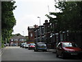
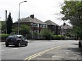
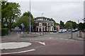
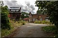
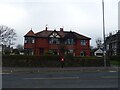
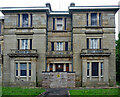
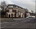
Photos of M5 5JF


Area Information
Living in M5 5JF means inhabiting a compact residential cluster in England, where 1,552 people reside across 4,612 square metres. This postcode’s density is striking — over 336,000 people per square kilometre — yet it remains a distinct, tightly woven community. Daily life here is shaped by proximity to key infrastructure: five metro stations, including Weaste and Langworthy, offer swift access to Manchester’s urban core. Retail options like M&S WHS and Tesco Salford are within practical reach, while rail links such as Eccles and Salford Crescent stations connect residents to broader networks. The area’s broadband score of 94 ensures reliable internet, though mobile coverage at 85 is slightly less robust. Despite its small size, M5 5JF balances urban convenience with a sense of locality, though its high crime risk score of 0 demands caution. For those prioritising connectivity and proximity to amenities, this area offers a blend of practicality and accessibility, though its challenges must be weighed carefully.
- Area Type
- Postcode
- Area Size
- 4612 m²
- Population
- 1552
- Population Density
- 3812 people/km²
M5 5JF is a small area where 46% of homes are owner-occupied, with the remaining 54% likely rented. The accommodation type is predominantly houses, which is unusual for urban postcode clusters. This suggests a mix of detached or semi-detached properties, possibly older stock given the area’s density. The limited size of the postcode means the housing stock is finite, which could affect availability and competition for buyers. For those seeking a home here, the focus on owner-occupation may indicate a desire for long-term investment, though the rental market’s role is unclear. Proximity to transport hubs and retail may make it appealing for commuters, but the small footprint means buyers must consider immediate surroundings for additional options.
House Prices in M5 5JF
Showing 10 properties
| Address | Type | Beds | Baths | Last Sale Price | Last Sale Date | |
|---|---|---|---|---|---|---|
| 6 Garner Drive, Salford, M5 5JF | Semi-detached | 3 | 1 | £165,000 | Dec 2017 | |
| 7 Garner Drive, Salford, M5 5JF | Semi-detached | 3 | 1 | £120,000 | Jan 2017 | |
| 10 Garner Drive, Salford, M5 5JF | Detached | 2 | 2 | £150,000 | Sep 2015 | |
| 5 Garner Drive, Salford, M5 5JF | house | 3 | - | £140,000 | Apr 2012 | |
| 2 Garner Drive, Salford, M5 5JF | Semi-detached | - | - | £77,000 | Nov 2002 | |
| 9 Garner Drive, Salford, M5 5JF | Detached | - | - | £65,000 | Nov 2000 | |
| 8 Garner Drive, Salford, M5 5JF | Semi-detached | - | - | £41,925 | Jun 1995 | |
| 1 Garner Drive, Salford, M5 5JF | house | - | - | - | - | |
| 4 Garner Drive, Salford, M5 5JF | Semi-detached | - | - | - | - | |
| 3 Garner Drive, Salford, M5 5JF | Semi-detached | - | - | - | - |
Energy Efficiency in M5 5JF
Daily life in M5 5JF is shaped by its proximity to retail, transport, and leisure hubs. Nearby shops include M&S WHS, Lidl Pendleton, and Tesco Salford, offering essentials and convenience. Metro stations like Weaste and Langworthy provide quick access to Manchester’s cultural and commercial districts, while rail links such as Manchester United FC Station cater to football fans. The area’s single bus stop and nearby airport ensure connectivity for both locals and visitors. Though small, the postcode’s amenities reflect a balance of practicality and urban vibrancy, with residents able to enjoy shopping, transport, and leisure options within a short reach.
Amenities
Schools
The only school listed near M5 5JF is Margaret Whitehead School, a special educational institution. No other schools are noted in the data, which may limit options for families requiring mainstream primary or secondary education. The presence of a special school suggests the area may cater to specific needs, but those prioritising traditional schooling might find limited choices. Prospective residents with children should investigate nearby districts for additional educational facilities, as the current data does not reflect a comprehensive school network within the postcode itself.
| Rank | School | Type | Entry gender | Ages |
|---|
Explore more schools in this area
Go to Schools tabDemographics
The population of M5 5JF skews towards adults aged 30–64, with a median age of 47. Home ownership here is relatively low at 46%, suggesting a mix of renters and owner-occupiers. The predominant ethnic group is White, though no specific data on diversity or deprivation is provided. The age profile indicates a community of working-age individuals, likely balancing careers with family life. With no children’s schools listed in the area, it may cater to professionals or those with children attending nearby institutions. The lack of detailed diversity metrics means broader social dynamics remain unexplored, but the demographic focus on middle-aged residents suggests a stable, perhaps mature community.
Household Size
Accommodation Type
Tenure
Ethnic Group
Religion
Household Composition
Age
Household Deprivation
NS-SEC
Explore more demographic insights in this area
Go to Demographics tabPlanning
Planning Constraints
- Flood RiskPremium
- Ramsar Wetland SitesPremium
- Area of Outstanding Natural BeautyPremium
- Protected Nature ReservePremium
- Protected WoodlandPremium