Area Overview for M5 5AP
Photos of M5 5AP


Area Information
Living in M5 5AP means inhabiting a compact, densely populated residential cluster in England. The area covers just 2124 square metres, housing 2038 people in a high-density arrangement of 959639 people per square kilometre. This makes it an intensely localised community, where daily life is shaped by proximity to amenities and services. The area’s small size means residents are likely to know their neighbours, with a mix of long-term residents and those drawn to the practicality of living in a well-connected part of the city. M5 5AP is not a sprawling suburb but a tightly woven cluster of flats, reflecting its predominantly rental-based housing stock. The area’s character is defined by its accessibility to transport networks, retail hubs, and educational facilities, making it a pragmatic choice for those prioritising convenience over space. While the population density is striking, the area’s compact nature ensures that essential services are within walking distance, fostering a sense of immediacy in daily routines.
- Area Type
- Postcode
- Area Size
- 2124 m²
- Population
- 2038
- Population Density
- 2900 people/km²
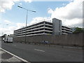
The property market in M5 5AP is characterised by a low home ownership rate of 29%, indicating that the area is not a traditional owner-occupied neighbourhood but rather a rental-focused market. The predominant accommodation type is flats, which aligns with the high population density and compact nature of the area. This suggests a housing stock designed for efficiency rather than individual ownership, likely catering to commuters or those prioritising affordability over property investment. For buyers, the small size of M5 5AP means that available properties are limited to the immediate cluster, with little scope for expansion into surrounding areas. The focus on flats may also mean that prospective buyers should consider the practicalities of shared living spaces and potential noise from nearby units. The rental market here is likely competitive, with demand driven by proximity to transport links and amenities.
House Prices in M5 5AP
No properties found in this postcode.
Energy Efficiency in M5 5AP
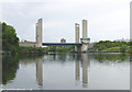
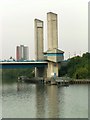
Life in M5 5AP is shaped by its proximity to a variety of amenities within practical reach. Retail options include Lidl West, M&S WHS, and Iceland Eccles, offering everyday shopping needs. The metro system, with stations such as Ladywell and Weaste, provides easy access to urban centres, while rail services at Eccles and Salford Crescent stations connect to broader regional networks. The area’s nearness to City Airport Manchester makes travel convenient for those needing to fly. For leisure, the presence of multiple bus stops and coach stations supports both local and longer-distance travel. The compact nature of the area means that residents can access shops, transport, and services without needing a car, fostering a walkable, community-oriented lifestyle. The mix of retail, transport, and connectivity options ensures that daily life in M5 5AP is efficient and well-served.
Amenities
Schools
Residents of M5 5AP have access to a range of educational facilities, including Stott Lane Nursery School and Ladywell Community Nursery Centre, both of which provide early years education. For older children, The Canterbury Centre and Arbour Academy are notable institutions, though their specific educational focus is not detailed in the data. The presence of both nursery and other schools suggests a mixed offering for families, with options for early education and broader schooling. However, the lack of Ofsted ratings or specific curriculum details means that parents must conduct their own evaluations of these institutions. The proximity of these schools to the area reinforces its appeal for families seeking accessible educational options, though the types of schools available may influence the suitability for different family needs.
| Rank | School | Type | Entry gender | Ages |
|---|
Explore more schools in this area
Go to Schools tabDemographics
M5 5AP’s population is predominantly composed of adults aged 30–64, with a median age of 47. This suggests a mature, settled community, likely with established careers and family structures. Home ownership is low, at 29%, indicating that most residents are renters rather than property owners. The accommodation type is almost exclusively flats, reflecting a high proportion of multi-unit housing. The predominant ethnic group is White, though no specific diversity statistics are provided. The high population density—959639 people per square kilometre—implies a tightly packed living environment, which may influence the area’s social dynamics and demand for shared spaces. For families, this density could mean limited private outdoor space but proximity to communal amenities. The age profile suggests a community with a strong presence of middle-aged professionals and retirees, potentially shaping local services and leisure options.
Household Size
Accommodation Type
Tenure
Ethnic Group
Religion
Household Composition
Age
Household Deprivation
NS-SEC
Explore more demographic insights in this area
Go to Demographics tabPlanning
Planning Constraints
- Flood RiskPremium
- Ramsar Wetland SitesPremium
- Area of Outstanding Natural BeautyPremium
- Protected Nature ReservePremium
- Protected WoodlandPremium