Area Overview for M5 5BJ
Photos of M5 5BJ


Area Information
M5 5BJ is a compact residential postcode in England, covering just 2.9 hectares and home to 1275 residents. Its high population density of 44,389 people per square kilometre reflects a tightly knit community, though the area’s small size means it is more of a cluster than a sprawling suburb. The median age of 22 contrasts with the most common age range of 30-64, suggesting a mix of younger residents and families. This postcode is characterised by its focus on flat living, with 13% of homes owned by residents and the majority rented. Proximity to Eccles Railway Station, Patricroft Station, and Salford Crescent Station, along with nearby City Airport Manchester, ensures strong transport links. Daily life here is shaped by its proximity to retail hubs like M&S WHS and Iceland Eccles, as well as the availability of multiple bus and metro stops. While the area lacks natural landscapes, its density and connectivity make it a practical choice for those prioritising convenience over space.
- Area Type
- Postcode
- Area Size
- 2.9 hectares
- Population
- 1275
- Population Density
- 1527 people/km²
The property market in M5 5BJ is overwhelmingly rental-focused, with only 13% of homes owned by residents. This low home ownership rate suggests a transient population, likely drawn by the area’s proximity to transport hubs and retail amenities. The accommodation type is almost entirely flats, which aligns with the postcode’s small footprint and high density. For buyers, this means the area is not a traditional owner-occupied market but rather a niche for those seeking short-term or investment properties. The limited housing stock and focus on flats may make it challenging to find owner-occupied options, though proximity to Eccles and Salford Crescent railway stations could appeal to commuters. Those considering the area should note that property availability is constrained by its size and the dominance of rental units.
House Prices in M5 5BJ
No properties found in this postcode.
Energy Efficiency in M5 5BJ
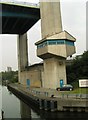
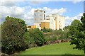
Living in M5 5BJ offers access to a range of amenities within practical reach. Retail options include M&S WHS, Lidl West, and Iceland Eccles, providing everyday shopping convenience. The metro stops at Ladywell, Weaste, and Langworthy serve as focal points for leisure and transport, while rail stations connect to broader networks. The proximity to City Airport Manchester makes travel straightforward for those needing frequent flights. Though the area lacks parks or green spaces, the density of amenities ensures residents can access dining, shopping, and transport without long commutes. The mix of retail, transport, and connectivity contributes to a practical, urban lifestyle, ideal for those prioritising efficiency over expansive outdoor spaces.
Amenities
Schools
The only school explicitly listed near M5 5BJ is Martindale Preparatory School, an independent institution. No state schools are mentioned in the data, which means families relying on public education would need to look beyond the immediate area. The presence of an independent school suggests a focus on private education, potentially attracting households prioritising specific curricula or facilities. However, the absence of state schools raises questions about accessibility for those without the means to afford private tuition. For parents seeking a range of educational options, the area’s limited school diversity may be a drawback, requiring careful consideration of commuting distances to nearby state schools.
| Rank | School | Type | Entry gender | Ages |
|---|
Explore more schools in this area
Go to Schools tabDemographics
The population of M5 5BJ skews heavily towards adults aged 30-64, with a median age of 22 suggesting a younger demographic is also present. Only 13% of residents own their homes, indicating a rental-dominated market. Flats are the primary accommodation type, reflecting the area’s compact nature. The predominant ethnic group is White, though specific diversity metrics are not provided. The high population density of 44,389 people per square kilometre implies a tightly packed community, which may influence social dynamics and local services. For families, the lack of data on deprivation or income levels means quality of life factors like access to amenities and transport must be assessed through other metrics. The presence of Martindale Preparatory School, an independent institution, suggests a focus on private education, though no state schools are listed in the area.
Household Size
Accommodation Type
Tenure
Ethnic Group
Religion
Household Composition
Age
Household Deprivation
NS-SEC
Explore more demographic insights in this area
Go to Demographics tabPlanning
Planning Constraints
- Flood RiskPremium
- Ramsar Wetland SitesPremium
- Area of Outstanding Natural BeautyPremium
- Protected Nature ReservePremium
- Protected WoodlandPremium