Area Overview for M5 5AH
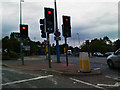
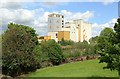
Photos of M5 5AH


Area Information
Living in M5 5AH means inhabiting a compact residential cluster in England, where 2,038 people are spread across 8,371 square metres. The area’s high population density of 243,457 people per square kilometre reflects its small footprint and tight-knit character. Residents here are likely to find daily life shaped by proximity to key amenities. The postcode’s compact size means most needs are within walking or short transit distance. Nearby rail stations, such as Eccles and Salford Crescent, offer easy access to Manchester’s broader network, while retail options like Lidl West and Iceland Eccles provide convenience. The area’s blend of flats and rental properties suggests a mix of transient and long-term residents. While the population is small, the density creates a sense of community, though it may feel more utilitarian than suburban. For those prioritising connectivity and practicality over sprawling landscapes, M5 5AH offers a focused, efficient living environment.
- Area Type
- Postcode
- Area Size
- 8371 m²
- Population
- 2038
- Population Density
- 2900 people/km²
The property market in M5 5AH is characterised by a low home ownership rate of 29%, suggesting that most residents rent rather than own their homes. The accommodation type is predominantly flats, which fits with the area’s high density and small footprint. This configuration may appeal to those seeking affordable, compact living, but it also means the housing stock is limited in variety. For buyers, the small size of the postcode and its immediate surroundings may restrict options, though the proximity to rail and retail hubs could offset this. The rental market likely dominates, with flats offering practicality for short- or medium-term stays. However, the lack of data on property prices or availability means potential buyers should investigate local listings directly. The area’s compactness may also mean that proximity to amenities outweighs concerns about housing diversity.
House Prices in M5 5AH
Showing 42 properties
Energy Efficiency in M5 5AH
Residents of M5 5AH have access to a range of amenities within easy reach. The area is served by five metro stops, including Ladywell and Parkway, and five rail stations, such as Eccles and Patricroft, facilitating quick travel to nearby towns and cities. Retail options are plentiful, with stores like Lidl West, M&S WHS, and Iceland Eccles providing daily essentials. The proximity to City Airport Manchester adds to the area’s appeal for frequent travellers. For leisure, the nearby Chorlton Street Coach Station connects to broader networks, while the density of amenities suggests a practical, convenience-driven lifestyle. The mix of retail, transport, and services means daily life in M5 5AH is efficient, though the small size may limit larger recreational spaces.
Amenities
Schools
Residents of M5 5AH have access to several educational institutions, including Stott Lane Nursery School and Ladywell Community Nursery Centre, both of which cater to early years education. For older children, The Canterbury Centre and Arbour Academy are listed, though their specific educational focus or Ofsted ratings are not detailed in the data. The presence of nursery schools indicates that the area supports young families, but the absence of primary or secondary schools with clear classifications limits the ability to assess educational quality. The mix of nursery and unspecified institutions may mean parents need to look beyond the immediate postcode for comprehensive schooling options. Families should verify the exact roles and standards of these schools through official sources to make informed decisions.
| Rank | School | Type | Entry gender | Ages |
|---|
Explore more schools in this area
Go to Schools tabDemographics
The median age in M5 5AH is 47, with the majority of residents falling into the 30–64 age range. This suggests a community skewed towards working-age adults, possibly including professionals and families. Only 29% of homes are owner-occupied, indicating a rental-heavy market, which may reflect the area’s compact nature and limited housing stock. The predominant accommodation type is flats, aligning with the high density. The predominant ethnic group is White, though the data does not specify further diversity metrics. With 2,038 residents, the area is small enough that local dynamics are likely to be tightly woven. The absence of specific deprivation data means it is unclear whether economic challenges impact quality of life, but the high population density and limited housing options may influence living conditions.
Household Size
Accommodation Type
Tenure
Ethnic Group
Religion
Household Composition
Age
Household Deprivation
NS-SEC
Explore more demographic insights in this area
Go to Demographics tabPlanning
Planning Constraints
- Flood RiskPremium
- Ramsar Wetland SitesPremium
- Area of Outstanding Natural BeautyPremium
- Protected Nature ReservePremium
- Protected WoodlandPremium