Area Overview for M5 5AF
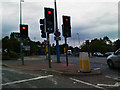
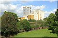
Photos of M5 5AF


Area Information
Living in M5 5AF means inhabiting a compact, densely populated residential cluster in England. The area covers 9,682 square metres and is home to 2,038 people, translating to a population density of over 210,000 per square kilometre. This suggests a tightly knit community, likely centred around shared amenities and local services. The area’s proximity to Eccles Railway Station, Salford Crescent Station, and nearby bus routes positions it as a convenient hub for commuters. Residents benefit from proximity to City Airport Manchester, just a short journey away, while retail options like Lidl West and Iceland Eccles cater to daily needs. The mix of flats and older housing stock reflects a balance between established dwellings and modern living. With a median age of 47, the community is predominantly composed of adults aged 30–64, indicating a stable, mature demographic. This area is practical for those prioritising connectivity, affordability, and access to essential services over expansive green spaces.
- Area Type
- Postcode
- Area Size
- 9682 m²
- Population
- 2038
- Population Density
- 2900 people/km²
The property market in M5 5AF is characterised by a low home ownership rate of 29%, indicating that the majority of the housing stock is rented out. The predominant accommodation type is flats, which is typical of densely populated urban areas. This suggests a mix of older housing developments and purpose-built blocks, likely offering smaller, more affordable units. The limited area size and high population density mean that property options are constrained to the immediate vicinity. Buyers should consider the area’s compact nature and the potential for limited future development. For those seeking rental properties, the availability of flats may provide a practical solution, though competition could be fierce given the area’s popularity for its transport links and amenities. The market is unlikely to cater to larger family homes, making it more suited to individuals or couples.
House Prices in M5 5AF
Showing 42 properties
Energy Efficiency in M5 5AF
Residents of M5 5AF enjoy a practical lifestyle supported by a range of nearby amenities. Retail options include Lidl West, M&S WHS, and Iceland Eccles, providing access to groceries, clothing, and household essentials. The area’s proximity to metro stations like Ladywell, Weaste, and Parkway offers convenience for leisure, shopping, and commuting. Eccles Railway Station and Salford Crescent Station further expand connectivity. The presence of City Airport Manchester within reach adds to the area’s accessibility. While there is no mention of parks or recreational spaces in the data, the mix of retail, transport, and travel options suggests a focus on efficiency over expansive green areas. The compact nature of the area means that daily needs can be met without long commutes, though residents may need to venture slightly further for larger leisure facilities.
Amenities
Schools
Residents of M5 5AF have access to a range of educational facilities within practical reach. The area includes two nurseries: Stott Lane Nursery School and Ladywell Community Nursery Centre, both of which cater to early years education. Additionally, The Canterbury Centre and Arbour Academy are listed as other educational institutions, though their specific levels (e.g. primary, secondary) are not detailed. The presence of nurseries suggests that the area supports families with young children, while the inclusion of other schools may indicate a broader educational infrastructure. However, the absence of Ofsted ratings means that the quality of these institutions cannot be assessed directly from the data. For families prioritising proximity to schools, the combination of nursery and other educational options provides a foundation for planning childcare and schooling needs.
| Rank | School | Type | Entry gender | Ages |
|---|
Explore more schools in this area
Go to Schools tabDemographics
The demographic profile of M5 5AF is defined by a median age of 47, with the most common age range being adults between 30 and 64 years. This suggests a community of established professionals and families, rather than a younger or elderly population. Home ownership in the area is relatively low at 29%, implying that the majority of residents are renters. The accommodation type is predominantly flats, which aligns with the area’s high population density and compact footprint. The predominant ethnic group is White, though specific diversity statistics are not provided. The age profile and ownership data indicate a stable, long-term resident base, with limited turnover. The low home ownership rate may reflect the area’s status as a rental market, potentially influenced by its proximity to transport links and amenities. For buyers, this suggests a focus on rental properties rather than owner-occupied homes.
Household Size
Accommodation Type
Tenure
Ethnic Group
Religion
Household Composition
Age
Household Deprivation
NS-SEC
Explore more demographic insights in this area
Go to Demographics tabPlanning
Planning Constraints
- Flood RiskPremium
- Ramsar Wetland SitesPremium
- Area of Outstanding Natural BeautyPremium
- Protected Nature ReservePremium
- Protected WoodlandPremium