Area Overview for M5 4UF
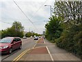
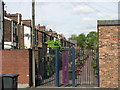
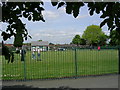
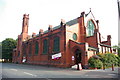
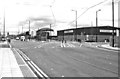
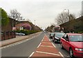
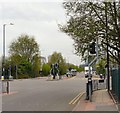
Photos of M5 4UF


Area Information
Living in M5 4UF means inhabiting a tightly packed residential cluster in England, where 2,121 people reside across just 9,350 square metres. This density creates a compact, densely populated environment, typical of urban areas. The area’s proximity to Salford Crescent Railway Station, Manchester United FC Railway Station, and Salford Central Railway Station ensures strong transport links, while nearby retail hubs like Lidl Pendleton and Sainsburys Salford provide daily convenience. The community is young, with a median age of 22, though the most common age range is 30–64, suggesting a mix of young professionals and families. The area’s small size and high density mean it is not a sprawling suburb but a focused, tightly knit neighbourhood. Its location near MediaCityUK also ties it to broader economic and cultural networks, offering access to secondary schools like UTC@MediacityUK and AldridgeUTC@MediaCityUK. For those seeking a compact, connected urban lifestyle, M5 4UF offers proximity to amenities but demands consideration of its high population density.
- Area Type
- Postcode
- Area Size
- 9350 m²
- Population
- 2121
- Population Density
- 4141 people/km²
The property market in M5 4UF is characterised by a low home ownership rate of 20%, indicating that the majority of residents rent their homes. Flats dominate the accommodation stock, which is typical of high-density urban areas. This suggests a rental market rather than a buyer-occupied one, with limited scope for owner-occupation. The area’s small size means housing stock is constrained, and buyers should consider the challenges of finding properties for purchase. The focus on flats also implies that the market caters more to tenants than to families seeking larger homes. For those exploring the area, the property landscape is best suited to renters or investors targeting short-term lets, rather than buyers seeking long-term ownership.
House Prices in M5 4UF
Showing 60 properties
| Address | Type | Beds | Baths | Last Sale Price | Last Sale Date | |
|---|---|---|---|---|---|---|
| 7 Constance Gardens, Salford, M5 4UF | Flat | - | - | - | - | |
| 5 Constance Gardens, Salford, M5 4UF | Flat | - | - | - | - | |
| 13 Constance Gardens, Salford, M5 4UF | Flat | - | - | - | - | |
| 31 Constance Gardens, Salford, M5 4UF | Flat | - | - | - | - | |
| 43 Constance Gardens, Salford, M5 4UF | Flat | - | - | - | - | |
| 29 Constance Gardens, Salford, M5 4UF | Flat | - | - | - | - | |
| 23 Constance Gardens, Salford, M5 4UF | Flat | - | - | - | - | |
| 26 Constance Gardens, Salford, M5 4UF | Flat | - | - | - | - | |
| 24 Constance Gardens, Salford, M5 4UF | Flat | - | - | - | - | |
| 32 Constance Gardens, Salford, M5 4UF | Flat | - | - | - | - |
Energy Efficiency in M5 4UF
Residents of M5 4UF enjoy a range of amenities within practical reach. Retail options include Lidl Pendleton, Sainsburys Salford, and Aldi Pendleton, ensuring daily shopping needs are met. The area’s proximity to Salford Crescent Railway Station, Manchester United FC Railway Station, and Salford Central Railway Station enhances connectivity, while the nearby City Airport Manchester offers travel convenience. Metro hubs like Langworthy, Broadway, and Harbour City provide access to broader urban amenities. Though the data does not specify parks or leisure venues, the presence of multiple retail and transport points suggests a lifestyle focused on convenience and accessibility. The compact nature of the area means amenities are tightly clustered, reducing travel time for essentials but requiring consideration of space constraints.
Amenities
Schools
Residents of M5 4UF have access to two secondary schools: UTC@MediacityUK and AldridgeUTC@MediaCityUK. The latter holds a ‘good’ Ofsted rating, offering families a reliable option for secondary education. Both schools are part of the broader MediaCityUK complex, which may provide additional facilities or resources. The absence of primary schools in the data suggests that families may need to look beyond the immediate area for younger education. However, the presence of two secondary schools within reach offers some choice for older children. The quality of secondary education here is a key consideration for families prioritising academic provision, though the lack of primary schools may require planning for commuting or alternative schooling options.
| Rank | School | Type | Entry gender | Ages |
|---|
Explore more schools in this area
Go to Schools tabDemographics
M5 4UF has a median age of 22, but the most common age group is adults aged 30–64, indicating a mix of young professionals and older residents. Only 20% of homes are owner-occupied, with flats being the predominant accommodation type. This suggests a rental-heavy market, where many residents may be tenants rather than homeowners. The area’s population density of 226,851 people per square kilometre is exceptionally high, reflecting a tightly packed urban environment. The predominant ethnic group is White, though no specific data on other groups is provided. The high density and low home ownership could influence community dynamics, potentially fostering a transient population. For buyers, this means the area is not ideal for long-term property investment focused on ownership, but it offers rental opportunities in a compact, well-serviced setting.
Household Size
Accommodation Type
Tenure
Ethnic Group
Religion
Household Composition
Age
Household Deprivation
NS-SEC
Explore more demographic insights in this area
Go to Demographics tabPlanning
Planning Constraints
- Flood RiskPremium
- Ramsar Wetland SitesPremium
- Area of Outstanding Natural BeautyPremium
- Protected Nature ReservePremium
- Protected WoodlandPremium