Area Overview for M5 4UA
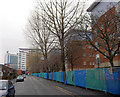
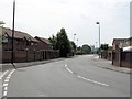
Photos of M5 4UA


Area Information
Living in M5 4UA means inhabiting a tightly packed residential cluster in England, where 2,121 people reside across just 1.2 hectares. The area’s compact size and high population density of 175,863 people per square kilometre reflect a densely populated, urban environment. This postcode is characterised by its proximity to key transport hubs and retail centres, making it a practical choice for those prioritising convenience. The community is predominantly young, with a median age of 22, though the most common age group is adults aged 30–64. This mix suggests a blend of students, professionals, and families. Daily life here is shaped by the area’s limited space and the need for efficient use of resources. While the population is small, the density creates a vibrant, interconnected environment. Residents benefit from proximity to major infrastructure, including rail stations and shopping centres, though the compact nature of the area means space is at a premium. M5 4UA is a microcosm of urban living, where proximity to amenities comes at the cost of limited personal space.
- Area Type
- Postcode
- Area Size
- 1.2 hectares
- Population
- 2121
- Population Density
- 4141 people/km²
The property market in M5 4UA is dominated by rental properties, with only 20% of residents owning their homes. The accommodation type is primarily flats, a reflection of the area’s small size and urban layout. This suggests a housing stock that is suited to individuals or small households rather than larger families. The limited space and high population density mean that property availability is constrained, and the market is likely competitive. For buyers, the area’s proximity to transport links and retail amenities may offset its lack of spacious housing. However, the dominance of rental properties indicates that owner-occupation is not the norm here. Those considering purchasing property in M5 4UA should be prepared for a market where flats are the standard, and the small area size may limit options for larger homes.
House Prices in M5 4UA
Showing 24 properties
| Address | Type | Beds | Baths | Last Sale Price | Last Sale Date | |
|---|---|---|---|---|---|---|
| 18 Quay View, Salford, M5 4UA | house | - | - | - | - | |
| 2 Quay View, Salford, M5 4UA | house | - | - | - | - | |
| 1 Quay View, Salford, M5 4UA | house | - | - | - | - | |
| 22 Quay View, Salford, M5 4UA | Bungalow | - | - | - | - | |
| 7 Quay View, Salford, M5 4UA | Terraced | - | - | - | - | |
| 10 Quay View, Salford, M5 4UA | house | - | - | - | - | |
| 21 Quay View, Salford, M5 4UA | house | - | - | - | - | |
| 27 Quay View, Salford, M5 4UA | Bungalow | - | - | - | - | |
| 12 Quay View, Salford, M5 4UA | Terraced | - | - | - | - | |
| 25 Quay View, Salford, M5 4UA | house | - | - | - | - |
Energy Efficiency in M5 4UA
Residents of M5 4UA have access to a range of amenities within practical reach. Retail options include Co-op Salford, Sainsburys Salford, and Morrisons Daily, offering everyday shopping needs. The area’s proximity to metro hubs like Anchorage, Harbour City, and Broadway provides leisure and dining opportunities. Rail stations such as Salford Crescent and Salford Central connect residents to broader networks, while the nearby City Airport Manchester facilitates travel. The compact nature of the area means amenities are concentrated, reducing travel time for essentials. This density supports a lifestyle where convenience and accessibility are prioritised, though personal space is limited. The mix of retail, transport, and leisure facilities creates a functional environment for daily life, though the area’s small size may not appeal to those seeking expansive outdoor spaces.
Amenities
Schools
Residents of M5 4UA have access to two secondary schools: UTC@MediacityUK and AldridgeUTC@MediaCityUK. Both institutions cater to older students, offering specialist education in technical and vocational fields. AldridgeUTC@MediaCityUK holds an Ofsted rating of ‘good’, which may appeal to families seeking quality secondary education. The presence of two secondary schools in the area provides options for students, though the absence of primary schools is not mentioned in the data. For families, the availability of secondary education is a key consideration, particularly given the area’s focus on adult and student demographics. The schools’ locations and ratings should be evaluated in the context of commuting distances and educational priorities.
| Rank | School | Type | Entry gender | Ages |
|---|
Explore more schools in this area
Go to Schools tabDemographics
The demographic profile of M5 4UA reveals a young and adult-dominated population. With a median age of 22 and the most common age range being adults aged 30–64, the area is a mix of students, professionals, and families. Home ownership is relatively low at 20%, indicating that the majority of residents rent their accommodation. The primary form of housing is flats, reflecting the area’s compact size and urban character. The predominant ethnic group is White, though the data does not specify the proportion of other ethnicities. The high population density of 175,863 people per square kilometre suggests a tightly packed community where shared spaces and communal living are the norm. This density can impact quality of life, potentially increasing demand for services and amenities. The demographic makeup points to a community that is likely dynamic and diverse in terms of age, though data on broader diversity is not provided.
Household Size
Accommodation Type
Tenure
Ethnic Group
Religion
Household Composition
Age
Household Deprivation
NS-SEC
Explore more demographic insights in this area
Go to Demographics tabPlanning
Planning Constraints
- Flood RiskPremium
- Ramsar Wetland SitesPremium
- Area of Outstanding Natural BeautyPremium
- Protected Nature ReservePremium
- Protected WoodlandPremium