Area Overview for M5 4GJ
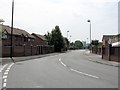
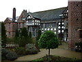
Photos of M5 4GJ


Area Information
M5 4GJ is a compact residential postcode in England, covering just 1.4 hectares yet home to 2271 residents. Its high population density of 168,035 people per square kilometre reflects a tightly packed community, typical of urban or semi-urban settings. The area is characterised by its proximity to a range of amenities, including schools, retail outlets, and transport hubs, making it convenient for daily life. With a median age of 22, the area skews younger, though the most common age group is adults aged 30–64, suggesting a mix of young professionals and families. The presence of multiple schools, including a primary and an academy with a good Ofsted rating, indicates a focus on education. Residents benefit from strong digital connectivity, with broadband and mobile scores in the upper range of their scales. However, the area’s small size means its housing stock is limited, and the 19% home ownership rate points to a rental-dominated market. For buyers, this suggests competition for available properties and a need to consider proximity to nearby amenities.
- Area Type
- Postcode
- Area Size
- 1.4 hectares
- Population
- 2271
- Population Density
- 3638 people/km²
The property market in M5 4GJ is largely rental-focused, with only 19% of residents owning their homes. The accommodation type is predominantly houses, though the area’s small size of 1.4 hectares means housing stock is limited. This scarcity could make the market competitive for buyers, with properties likely to be in high demand. The high population density of 168,035 people per square kilometre suggests that available homes are closely spaced, possibly in terraced or semi-detached configurations. For buyers, the area’s proximity to schools, transport, and retail hubs may offset its small footprint. However, the limited housing stock and high demand could drive prices upward, making it a challenging market for first-time buyers. Those considering the area should also factor in the need for proximity to nearby amenities, as the immediate surroundings may hold additional opportunities.
House Prices in M5 4GJ
Showing 39 properties
| Address | Type | Beds | Baths | Last Sale Price | Last Sale Date | |
|---|---|---|---|---|---|---|
| 1 Joule Close, Salford, M5 4GJ | house | - | - | £20,240 | Sep 2003 | |
| 8 Joule Close, Salford, M5 4GJ | Terraced | - | - | £15,960 | Mar 2003 | |
| 10 Joule Close, Salford, M5 4GJ | Terraced | - | - | - | - | |
| 3 Joule Close, Salford, M5 4GJ | Terraced | - | - | - | - | |
| 31 Joule Close, Salford, M5 4GJ | Flat | - | - | - | - | |
| 38 Joule Close, Salford, M5 4GJ | Flat | - | - | - | - | |
| 36 Joule Close, Salford, M5 4GJ | Flat | - | - | - | - | |
| 22 Joule Close, Salford, M5 4GJ | house | - | - | - | - | |
| 24 Joule Close, Salford, M5 4GJ | house | - | - | - | - | |
| 23 Joule Close, Salford, M5 4GJ | Flat | - | - | - | - |
Energy Efficiency in M5 4GJ
Daily life in M5 4GJ is shaped by its proximity to a range of amenities. Retail options include Co-op Salford, Sainsburys Salford, and Morrisons Daily, providing essential shopping within walking distance. The area’s metro hubs, such as Anchorage and Harbour City, offer leisure and dining choices, while nearby rail stations like Salford Central and Salford Crescent connect residents to broader urban centres. The presence of City Airport Manchester adds to the area’s accessibility. Parks and open spaces are not explicitly mentioned, but the lack of environmental constraints like AONB or protected woodlands suggests room for recreational activities. The mix of retail, transport, and leisure facilities creates a convenient lifestyle, ideal for those prioritising accessibility and connectivity over expansive green spaces.
Amenities
Schools
Residents of M5 4GJ have access to a range of educational institutions, including Markendale Nursery School, which provides early years education, and Radclyffe Community Primary School, serving younger children. For secondary education, Oasis Academy MediaCityUK offers a good Ofsted rating, indicating a reliable standard of teaching. The combination of nursery, primary, and academy options ensures families can plan for their children’s education across multiple stages. The presence of a good-rated academy may be particularly appealing to parents seeking quality secondary schooling. The proximity of these schools to the area suggests that daily commutes for students are manageable, though families should consider the specific catchment areas for each institution. The variety of school types also reflects the area’s role as a hub for families requiring diverse educational pathways.
| Rank | School | Type | Entry gender | Ages |
|---|
Explore more schools in this area
Go to Schools tabDemographics
The population of M5 4GJ has a median age of 22, but the dominant age group is adults aged 30–64, indicating a community of working-age individuals and families. Only 19% of residents own their homes, with the majority renting, which aligns with the area’s small size and limited housing stock. The accommodation type is predominantly houses, though the high population density suggests these are likely smaller dwellings. The predominant ethnic group is White, with no specific data on other demographics provided. The low home ownership rate and high population density may reflect a transient or rental-focused population, which could impact the area’s social dynamics. For quality of life, the mix of age groups and housing types suggests a balance between young professionals and families, though the lack of detailed diversity data limits further analysis.
Household Size
Accommodation Type
Tenure
Ethnic Group
Religion
Household Composition
Age
Household Deprivation
NS-SEC
Explore more demographic insights in this area
Go to Demographics tabPlanning
Planning Constraints
- Flood RiskPremium
- Ramsar Wetland SitesPremium
- Area of Outstanding Natural BeautyPremium
- Protected Nature ReservePremium
- Protected WoodlandPremium