Area Overview for M45 8AE
Photos of M45 8AE


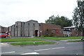
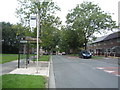
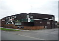
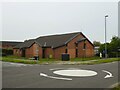
21 photos from this area
Area Information
Key information about the M45 8AE including its size, population, and administrative classification.
- Area Type
- Postcode
- Area Size
- 2378 m²
- Population
- 1869
- Population Density
- 3746 people/km²
House Prices in M45 8AE
9
Properties
£137,500
Average Sold Price
£82,500
Lowest Price
£200,000
Highest Price
Showing 9 properties
| Address | Type | Beds | Baths | Last Sale Price | Last Sale Date | |
|---|---|---|---|---|---|---|
| 106 Ribble Drive, Whitefield, M45 8AE | Terraced | 3 | 1 | £200,000 | Jul 2022 | |
| 110 Ribble Drive, Whitefield, M45 8AE | house | - | - | £166,000 | Jan 2021 | |
| 114 Ribble Drive, Whitefield, M45 8AE | Semi-detached | 3 | 1 | £162,000 | Aug 2020 | |
| 116 Ribble Drive, Whitefield, M45 8AE | Semi-detached | 3 | 1 | £150,000 | Mar 2020 | |
| 104 Ribble Drive, Whitefield, M45 8AE | Semi-detached | 2 | 1 | £125,000 | Oct 2018 | |
| 102 Ribble Drive, Whitefield, M45 8AE | Semi-detached | 2 | 1 | £125,000 | Nov 2017 | |
| 100 Ribble Drive, Whitefield, M45 8AE | house | 4 | 1 | £135,000 | Mar 2013 | |
| 112 Ribble Drive, Whitefield, M45 8AE | house | 3 | - | £92,000 | Apr 2004 | |
| 108 Ribble Drive, Whitefield, M45 8AE | house | - | - | £82,500 | Mar 2004 |
Energy Efficiency in M45 8AE
Amenities
Schools
| Rank | School | Type | Entry gender | Ages |
|---|
Explore more schools in this area
Go to Schools tabDemographics
Household Size
Family (3-5 people)
most common
Accommodation Type
Houses
most common
Tenure
56
majority
Ethnic Group
White
most common
Religion
N/A
most common
Household Composition
N/A
most common
Age
47
median
Adults (30-64 years)
most common
Household Deprivation
N/A
with no deprivation
NS-SEC
25
in Lower managerial occupations
Explore more demographic insights in this area
Go to Demographics tabPlanning
Planning Constraints
- Flood RiskPremium
- Ramsar Wetland SitesPremium
- Area of Outstanding Natural BeautyPremium
- Protected Nature ReservePremium
- Protected WoodlandPremium