Area Overview for M45 7WH
Photos of M45 7WH


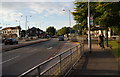
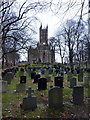


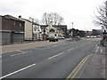
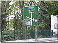
83 photos from this area
Area Information
Key information about the M45 7WH including its size, population, and administrative classification.
- Area Type
- Postcode
- Area Size
- 7770 m²
- Population
- 1421
- Population Density
- 3755 people/km²
House Prices in M45 7WH
10
Properties
£431,913
Average Sold Price
£234,500
Lowest Price
£635,000
Highest Price
Showing 10 properties
| Address | Type | Beds | Baths | Last Sale Price | Last Sale Date | |
|---|---|---|---|---|---|---|
| 143 Higher Lane, Whitefield, M45 7WH | Detached | 4 | 2 | £557,800 | Dec 2021 | |
| 135 Higher Lane, Whitefield, M45 7WH | house | - | - | £463,000 | Sep 2021 | |
| 141 Higher Lane, Whitefield, M45 7WH | house | - | - | £635,000 | May 2021 | |
| 133 Higher Lane, Whitefield, M45 7WH | Detached | 4 | 2 | £360,000 | Sep 2018 | |
| 127 Higher Lane, Whitefield, M45 7WH | Detached | 4 | 2 | £380,000 | Jun 2009 | |
| 125 Higher Lane, Whitefield, M45 7WH | Detached | - | - | £445,000 | May 2008 | |
| 131 Higher Lane, Whitefield, M45 7WH | Detached | 4 | 3 | £380,000 | Mar 2005 | |
| 129 Higher Lane, Whitefield, M45 7WH | Detached | - | - | £234,500 | Apr 2002 | |
| 139 Higher Lane, Whitefield, M45 7WH | Detached | 4 | 3 | - | - | |
| 137 Higher Lane, Whitefield, M45 7WH | Detached | - | - | - | - |
Energy Efficiency in M45 7WH
Amenities
Schools
| Rank | School | Type | Entry gender | Ages |
|---|
Explore more schools in this area
Go to Schools tabDemographics
Household Size
Two person
most common
Accommodation Type
Houses
most common
Tenure
85
majority
Ethnic Group
White
most common
Religion
N/A
most common
Household Composition
N/A
most common
Age
47
median
Adults (30-64 years)
most common
Household Deprivation
N/A
with no deprivation
NS-SEC
48
in Lower managerial occupations
Explore more demographic insights in this area
Go to Demographics tabPlanning
Planning Constraints
- Flood RiskPremium
- Ramsar Wetland SitesPremium
- Area of Outstanding Natural BeautyPremium
- Protected Nature ReservePremium
- Protected WoodlandPremium