Area Overview for M45 7PD
Photos of M45 7PD

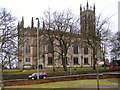
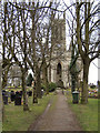
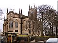
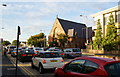

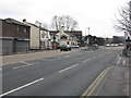
83 photos from this area
Area Information
Key information about the M45 7PD including its size, population, and administrative classification.
- Area Type
- Postcode
- Area Size
- 9189 m²
- Population
- 1421
- Population Density
- 3755 people/km²
House Prices in M45 7PD
17
Properties
£464,500
Average Sold Price
£282,500
Lowest Price
£710,000
Highest Price
Showing 17 properties
| Address | Type | Beds | Baths | Last Sale Price | Last Sale Date | |
|---|---|---|---|---|---|---|
| 8 Park Hill Drive, Whitefield, M45 7PD | house | 5 | 3 | £710,000 | Jun 2024 | |
| 1 Park Hill Drive, Whitefield, M45 7PD | Detached | 4 | 2 | £495,000 | May 2022 | |
| 18 Park Hill Drive, Whitefield, M45 7PD | Detached | 4 | 1 | £505,000 | Feb 2022 | |
| 5 Park Hill Drive, Whitefield, M45 7PD | Detached | 4 | - | £555,000 | Jan 2021 | |
| 4 Park Hill Drive, Whitefield, M45 7PD | Detached | 4 | 2 | £486,000 | Dec 2019 | |
| 9 Park Hill Drive, Whitefield, M45 7PD | Detached | 4 | - | £340,000 | Nov 2015 | |
| 20 Park Hill Drive, Whitefield, M45 7PD | Detached | 5 | - | £386,500 | Jul 2015 | |
| 3 Park Hill Drive, Whitefield, M45 7PD | Detached | 4 | 3 | £282,500 | Sep 2013 | |
| High Trees The Bungalow, Park Hill Drive, Whitefield, M45 7PD | Bungalow | - | - | £448,000 | Sep 2010 | |
| 10 Park Hill Drive, Whitefield, M45 7PD | house | - | - | £437,000 | Aug 2006 |
Page 1 of 2
Energy Efficiency in M45 7PD
Amenities
Schools
| Rank | School | Type | Entry gender | Ages |
|---|
Explore more schools in this area
Go to Schools tabDemographics
Household Size
Two person
most common
Accommodation Type
Houses
most common
Tenure
85
majority
Ethnic Group
White
most common
Religion
N/A
most common
Household Composition
N/A
most common
Age
47
median
Adults (30-64 years)
most common
Household Deprivation
N/A
with no deprivation
NS-SEC
48
in Lower managerial occupations
Explore more demographic insights in this area
Go to Demographics tabPlanning
Planning Constraints
- Flood RiskPremium
- Ramsar Wetland SitesPremium
- Area of Outstanding Natural BeautyPremium
- Protected Nature ReservePremium
- Protected WoodlandPremium