Area Overview for M35 0WS
Photos of M35 0WS

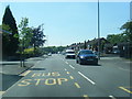
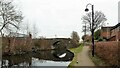
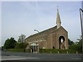
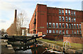
28 photos from this area
Area Information
Key information about the M35 0WS including its size, population, and administrative classification.
- Area Type
- Postcode
- Area Size
- 5579 m²
- Population
- 1193
- Population Density
- 213826 people/km²
House Prices in M35 0WS
24
Properties
£157,669
Average Sold Price
£54,500
Lowest Price
£229,950
Highest Price
Showing 24 properties
| Address | Type | Beds | Baths | Last Sale Price | Last Sale Date | |
|---|---|---|---|---|---|---|
| 65 Norfolk Crescent, Failsworth, M35 0WS | Semi-detached | 3 | 1 | £229,950 | Sep 2024 | |
| 67 Norfolk Crescent, Failsworth, M35 0WS | house | - | - | £185,000 | Jul 2022 | |
| 47 Norfolk Crescent, Failsworth, M35 0WS | Semi-detached | 3 | 1 | £212,000 | May 2022 | |
| 87 Norfolk Crescent, Failsworth, M35 0WS | house | - | - | £175,000 | Jan 2022 | |
| 61 Norfolk Crescent, Failsworth, M35 0WS | house | - | - | £190,800 | Sep 2021 | |
| 81 Norfolk Crescent, Failsworth, M35 0WS | house | - | - | £168,500 | Sep 2021 | |
| 59 Norfolk Crescent, Failsworth, M35 0WS | house | - | - | £170,000 | Feb 2021 | |
| 83 Norfolk Crescent, Failsworth, M35 0WS | Semi-detached | 3 | 1 | £162,000 | Jun 2018 | |
| 57 Norfolk Crescent, Failsworth, M35 0WS | Semi-detached | - | - | £150,000 | May 2010 | |
| 91 Norfolk Crescent, Failsworth, M35 0WS | house | - | - | £111,000 | Feb 2010 |
Page 1 of 3
Energy Efficiency in M35 0WS
Amenities
Schools
| Rank | School | Type | Entry gender | Ages |
|---|
Explore more schools in this area
Go to Schools tabDemographics
Household Size
Family (3-5 people)
most common
Accommodation Type
Houses
most common
Tenure
89
majority
Ethnic Group
White
most common
Religion
N/A
most common
Household Composition
N/A
most common
Age
47
median
Adults (30-64 years)
most common
Household Deprivation
N/A
with no deprivation
NS-SEC
27
in Lower managerial occupations
Explore more demographic insights in this area
Go to Demographics tabPlanning
Planning Constraints
- Flood RiskPremium
- Ramsar Wetland SitesPremium
- Area of Outstanding Natural BeautyPremium
- Protected Nature ReservePremium
- Protected WoodlandPremium